Nolte State Park

Nolte State Park

IUCN-Kategorie V – Protected Landscape/Seascape

Nolte State Park (Juli 2007)

Nolte State Park (Juli 2007)

Lage King County in Washington (USA)
Fläche 47 ha
Geographische Lage 47° 16′ N, 121° 56′ W47.269444-121.939167241Koordinaten: 47° 16′ 10″ N, 121° 56′ 21″ W
Nolte State Park (Washington)
Meereshöhe 241 m
Einrichtungsdatum 1972[1]
Verwaltung Washington State Parks and Recreation Commission
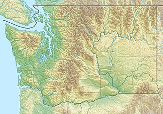
Der Nolte State Park ist ein 117 Acres (47 ha) großer State Park im US-Bundesstaat Washington etwa 6 mi (10 km) nordöstlich von Enumclaw und unmittelbar südlich von Cumberland an der Westgrenze der Kaskadenkette. Er enthält 7.174 ft (2.187 m) des Ufers des Deep Lake nahe dem Green River.[2] Das Grundstück war viele Jahre zuvor ein Resort und wurde dem Staat Anfang der 1970er Jahre von Minnie Nolte geschenkt.[1] Im See kommen Regenbogenforellen, Küsten-Cutthroat-Forellen, Rotlachse, Crappies und Katzenwelse vor.[3] Am See gibt es eine öffentliche Seebrücke zum Angeln, einen Strand und einen Wander-Weg rund um den See.[2] Die Slipanlage für Boote dient nur zum Einsetzen, Parken ist nur zeitweise möglich. Der Deep Lake hat eine Fläche von 39 Acres (16 ha) und ist maximal 76 ft (23 m) tief.[4]

Einzelnachweise

  1. a b Nolte State Park. Daffodil Valley Times, abgerufen am 16. Februar 2015. 
  2. a b Nolte State Park. Washington State Parks and Recreation Commission, abgerufen am 9. November 2017. 
  3. Deep Lake. In: Fishing & Shellfishing. Washington Department of Fish and Wildlife, abgerufen am 16. Februar 2015. 
  4. Deep Lake. In: King County Small Lakes Information and Data. King County, abgerufen am 16. Februar 2015. 
  • Nolte State Park Washington State Parks and Recreation Commission
State Parks des US-Bundesstaates Washington

Alta Lake | Anderson Lake | Battle Ground Lake | Bay View | Beacon Rock | Belfair | Birch Bay | Blake Island | Blind Island | Bogachiel | Bogachiel | Bridgeport | Bridle Trails | Brooks | Cama Beach | Camano Island | Cape Disappointment | Centennial Trail | Clark Island | Columbia Hills | Columbia Plateau Trail | Conconully | Crawford | Crow Butte | Curlew Lake | Cutts Island | Daroga | Dash Point | Deception Pass | Doe Island | Dosewallips | Doug’s Beach | Eagle Island | Federation Forest | Fields Spring | Flaming Geyser | Fort Casey | Fort Columbia | Fort Ebey | Fort Flagler | Fort Simcoe | Fort Townsend | Fort Worden | Ginkgo Petrified Forest | Goldendale Observatory | Grayland Beach | Griffiths-Priday | Hope Island (Mason) | Hope Island (Skagit) | Ike Kinswa | Illahee | Iron Horse | Jackson House | James Island | Jarrell Cove | Joemma Beach | Jones Island | Joseph Whidbey | Kanaskat-Palmer | Kinney Point | Kitsap | Klickitat Trail | Kopachuck | Lake Chelan | Lake Easton | Lake Sammamish | Lake Sylvia | Lake Wenatchee | Larrabee | Leadbetter Point | Lewis & Clark | Lewis & Clark Trail | Lime Kiln Point | Lincoln Rock | Lyons Ferry | Manchester | Maryhill | Matia Island | McMicken Island | Millersylvania | Moran | Mount Pilchuck | Mount Spokane | Mystery Bay | Nine Mile Recreation Area | Nolte | Obstruction Pass | Ocean City | Olallie | Olmstead Place | Pacific Beach | Pacific Pines | Palouse Falls | Paradise Point | Patos Island | Peace Arch | Pearrygin | Penrose Point | Peshastin Pinnacles | Pleasant Harbor | Posey Island | Potholes | Potlatch | Rainbow Falls | Rasar | Reed Island | Riverside | Rockport | Sacajawea | Saddlebag Island | Saint Edward | Saltwater | Scenic Beach | Schafer | Seaquest | Sequim Bay | Shine Tidelands | Skagit Island | South Whidbey | Spencer Spit | Spring Creek Hatchery | Squak Mountain | Squilchuck | Steamboat Rock | Steptoe Battlefield | Steptoe Butte | Stuart Island | Sucia Island | Sun Lakes-Dry Falls | Tolmie | Triton Cove | Turn Island | Twanoh | Twenty-Five Mile Creek | Twin Harbors | Wallace Falls | Wanapum Recreation Area | Wenatchee Confluence | Westport Light | Willapa Hills Trail | Yakima Sportsman