Academy, St. Louis
Neighborhood of St. Louis in Missouri, United States
Academy | |
|---|---|
Neighborhood of St. Louis | |
 Houses on Cabanne Avenue in Academy, January 2012 | |
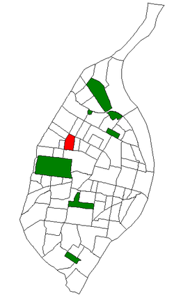 Location (red) of Academy within St. Louis | |
| Country | United States |
| State | Missouri |
| City | St. Louis |
| Wards | 18, 26 |
| Area | |
| • Total | 0.44 sq mi (1.1 km2) |
| Population (2020)[1] | |
| • Total | 2,355 |
| • Density | 5,400/sq mi (2,100/km2) |
| ZIP code(s) | Parts of 63108, 63113 |
| Area code(s) | 314 |
| Website | stlouis-mo.gov |
Academy/Sherman Park is a neighborhood in North St. Louis, just outside Central West End. The official boundaries of the area are Dr. Martin Luther King Drive on the north, Delmar Boulevard on the south, North Kingshighway Boulevard on the east, and Union Boulevard on the west.[2]
As of 2020,[3] there were 2,355 people residing in this neighborhood, which contained 1,276 housing units. The racial makeup of the neighborhood was 4.97% White, 87.26% Black, 1.10% Asian, 1.15% from some other race, and 5.27% from two or more races. Hispanic or Latino of any race were 2.29% of the population.
Sally Benson grew up in the Academy neighborhood. She described her childhood in her novels that inspired the film Meet Me in St. Louis. The Benson house at 5135 Kensington Avenue[4][5] no longer exists. After being sold, it fell into disrepair, eventually became uninhabitable, and was demolished in 1994.[6]
Tennessee Williams attended Soldan High School in the neighborhood and used it as a setting for his play The Glass Menagerie.[7]
| Census | Pop. | Note | %± |
|---|---|---|---|
| 1990 | 5,169 | — | |
| 2000 | 3,797 | −26.5% | |
| 2010 | 2,816 | −25.8% | |
| 2020 | 2,355 | −16.4% | |
| Sources:[8] | |||
References
- ^ "2020 Census Neighborhood Results".
- ^ Neighborhood Data Profile for Academy. Accessed 12 April 2008. Archived July 5, 2007, at the Wayback Machine
- ^ "City of St. Louis" (PDF).
- ^ "Google Maps".
- ^ ""Meet Me in St. Louis:" the Victorian on Kensington Avenue". 13 December 2009.
- ^ "Boom Nation: Meet Me in St. Louis". ABC News.
- ^ "Free Research Paper on Glass Menagerie Means 181 - 210". Cyberessays.com. Retrieved 2011-03-15.
- ^ "Academy Neighborhood Statistics". St Louis, MO. Retrieved 26 January 2023.
External links
- Academy neighborhood website
- v
- t
- e
- Academy
- Baden
- Benton Park
- Benton Park West
- Bevo Mill
- Botanical Heights
- Boulevard Heights
- Carondelet
- Carr Square
- Central West End
- Cheltenham
- Chinatown (defunct since 1966)
- Clayton/Tamm
- Clifton Heights
- College Hill
- Columbus Square
- Compton Heights
- Covenant Blu Grand Center
- DeBaliviere Place
- "Dogtown"
- Downtown
- Downtown West
- Dutchtown
- Ellendale
- Fairground
- Forest Park Southeast
- Fountain Park
- Fox Park
- Franz Park
- Gate District
- Gravois Park
- Greater Ville
- Hamilton Heights
- The Hill
- Hi-Pointe
- Holly Hills
- Hyde Park
- JeffVanderLou
- Kings Oak
- Kingsway East
- Kingsway West
- Kosciusko
- Lafayette Square
- LaSalle Park
- Lewis Place
- Lindenwood Park
- Marine Villa
- Mark Twain
- Mark Twain/I-70 Industrial
- McKinley Heights
- Midtown
- Mill Creek Valley (defunct since 1960s)
- Mount Pleasant
- Near North Riverfront
- Northampton
- North Point
- North Riverfront
- O'Fallon
- Old North St. Louis
- Patch
- Peabody–Darst–Webbe
- Penrose
- Princeton Heights
- Riverview
- Shaw
- Skinker DeBaliviere
- Soulard
- Southampton
- Southwest Garden
- St. Louis Hills
- St. Louis Place
- Tiffany
- Tower Grove East
- Tower Grove South
- Vandeventer
- The Ville
- Visitation Park
- Walnut Park East
- Walnut Park West
- Wells/Goodfellow
- West End
- Wydown/Skinker
38°39′30″N 90°16′02″W / 38.6584°N 90.2673°W / 38.6584; -90.2673
 | This St. Louis location article is a stub. You can help Wikipedia by expanding it. |
- v
- t
- e


