Andover, Virginia
Unincorporated community in Virginia, United States
36°55′25″N 82°47′48″W / 36.92361°N 82.79667°W / 36.92361; -82.7966724215
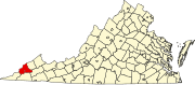
Andover is an unincorporated community in Wise County, Virginia, United States. Andover is located along Virginia State Route 78 1.4 miles (2.3 km) northwest of Appalachia. Andover had a post office until it closed on November 3, 2008; it still has its own ZIP code, 24215.[2][3]
References
- ^ "Andover". Geographic Names Information System. United States Geological Survey, United States Department of the Interior.
- ^ United States Postal Service (2012). "USPS - Look Up a ZIP Code". Retrieved February 15, 2012.
- ^ "Postmaster Finder - Post Offices by ZIP Code". United States Postal Service. Archived from the original on October 17, 2020. Retrieved December 22, 2012.
- v
- t
- e
Municipalities and communities of Wise County, Virginia, United States
County seat: Wise
- Big Stone Gap East
- Dunbar
- East Stone Gap
- Osaka
- Riverview
- Stonega
- Tacoma
- The University of Virginia's College at Wise
communities
‡This populated place also has portions in an adjacent county or counties
- Virginia portal
- United States portal
 | This Wise County, Virginia state location article is a stub. You can help Wikipedia by expanding it. |
- v
- t
- e


