Applewood, Colorado
 United States
 Colorado
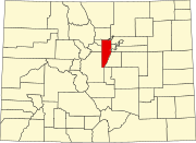
Applewood is an unincorporated community and a census-designated place (CDP) located in and governed by Jefferson County, Colorado, United States. The CDP is a part of the Denver–Aurora–Lakewood, CO Metropolitan Statistical Area. The population of the Applewood CDP was 7,833 at the 2020 United States Census.[3] The Golden post office (Zip code 80401) serves the area.[4]
History
In the 2000 U.S. Census, the size of the CDP was reduced from its size in the 1990 U.S. Census.[5][6] West Pleasant View CDP was formed out of parts of Applewood CDP in 2000.[7]
Geography
Applewood is 10 miles (16 km) west of downtown Denver. It is bordered to the north by Fairmount, to the northeast by Wheat Ridge, to the southeast by Lakewood, and to the southwest by West Pleasant View. South Table Mountain borders Applewood to the west.
The Applewood CDP has an area of 2,871 acres (11.619 km2) including 270 acres (1.092 km2) of water.[2]
Demographics
The United States Census Bureau initially defined the Applewood CDP for the 1970 United States Census.
| Year | Pop. | ±% |
|---|---|---|
| 1970 | 8,214 | — |
| 1980 | 12,040 | +46.6% |
| 1990 | 11,069 | −8.1% |
| 2000 | 7,123 | −35.6% |
| 2010 | 7,160 | +0.5% |
| 2020 | 7,833 | +9.4% |
| Source: United States Census Bureau | ||
Education
Applewood is within the Jefferson County School District R-1.[8]
Zoned schools for Applewood CDP (as defined in the 2020 U.S. Census) include:[9]
- Elementary schools:[10] Maple Grove,[11] Stober,[12] and Welchester[13]
- Middle schools:[14] Everitt Middle School,[15] and Bell Middle School[16]
- High schools:[17] for most areas, either Golden High School or Wheat Ridge High School (some areas are only zoned to Golden HS, and some areas are only zoned to Wheat Ridge HS)[18][19]
See also
- Front Range Urban Corridor
- North Central Colorado Urban Area
- Denver–Aurora, CO Combined Statistical Area
- Denver–Aurora–Lakewood, CO Metropolitan Statistical Area
References
- ^ a b c d U.S. Geological Survey Geographic Names Information System: Applewood, Colorado
- ^ a b "State of Colorado Census Designated Places - BAS20 - Data as of January 1, 2020". United States Census Bureau. Retrieved December 2, 2020.
- ^ a b United States Census Bureau. "Applewood CDP, Colorado". Retrieved April 15, 2023.
- ^ a b "Zip Code 80401 Map and Profile". zipdatamaps.com. 2020. Retrieved December 20, 2020.
- ^ "1990 COUNTY BLOCK MAP (RECREATED): JEFFERSON County" (PDF). U.S. Census Bureau. pp. 14, 18-19. Retrieved July 24, 2024.
- ^ "CENSUS 2000 BLOCK MAP: APPLEWOOD CDP" (PDF). U.S. Census Bureau. Retrieved July 24, 2024. - Pages 1 and 2
- ^ "CENSUS 2000 BLOCK MAP: WEST PLEASANT VIEW CDP" (PDF). U.S. Census Bureau. Retrieved July 24, 2024.
- ^ "2020 CENSUS - SCHOOL DISTRICT REFERENCE MAP: Jefferson County, CO" (PDF). U.S. Census Bureau. p. 1 (PDF p. 2/3). Retrieved July 24, 2024.
- ^ "2020 CENSUS - CENSUS BLOCK MAP: Applewood CDP, CO" (PDF). U.S. Census Bureau. Retrieved July 24, 2024.
- ^ "Elementary School Boundaries". Jefferson County Public Schools (Colorado). Retrieved July 24, 2024.
- ^ "Maple Grove Elementary School Boundary". Jefferson County Public Schools (Colorado). Retrieved July 24, 2024.
- ^ "Stober Elementary School Boundary". Jefferson County Public Schools (Colorado). Retrieved July 24, 2024.
- ^ "Welchester Elementary School Boundary". Jefferson County Public Schools (Colorado). Retrieved July 24, 2024.
- ^ "Middle School Boundaries". Jefferson County Public Schools (Colorado). Retrieved July 24, 2024.
- ^ "Everitt Middle School Boundary". Jefferson County Public Schools (Colorado). Retrieved July 24, 2024.
- ^ "Bell Middle School Boundary". Jefferson County Public Schools (Colorado). Retrieved July 24, 2024.
- ^ "High School Boundaries". Jefferson County Public Schools (Colorado). Retrieved July 24, 2024.
- ^ "Golden High School Boundary". Jefferson County Public Schools (Colorado). Retrieved July 24, 2024.
- ^ "Wheat Ridge High School Boundary". Jefferson County Public Schools (Colorado). Retrieved July 24, 2024.
External links
 Definitions from Wiktionary
 Media from Commons
 News from Wikinews
 Quotations from Wikiquote
 Texts from Wikisource
 Textbooks from Wikibooks
 Resources from Wikiversity
- Applewood Valley Association (AVA)
- Applewood Business Association
- Applewood Community
- Prospect Recreation & Park District
- Applewood Golf Course
- Jefferson County website
- Jeffco Public Schools
- v
- t
- e

communities
- Colorado portal
- United States portal


