Auburn metropolitan area, Alabama
Metropolitan Statistical Area in Alabama, United States
Auburn Metropolitan Area | ||
|---|---|---|
Metropolitan Statistical Area | ||
| Auburn–Opelika, Alabama Metropolitan Statistical Area | ||
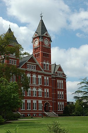 Samford Hall at Auburn University | ||
 Interactive Map of Auburn–Opelika, AL MSA
| ||
| Country |  United States United States | |
| State |  Alabama Alabama | |
| Largest city | Auburn | |
| Other cities |
| |
| Area | ||
| • Total | 1,570 sq mi (4,100 km2) | |
| Highest elevation | 928 ft (283 m) | |
| Population (2020 Census) | ||
| • Total | 174,241 | |
| • Rank | 231st in the U.S. | |
| Time zone | UTC−5 (CST) | |
| • Summer (DST) | UTC−4 (CDT) | |
The Auburn Metropolitan Area—officially the Auburn-Opelika, Alabama Metropolitan Statistical Area[1][2][3]—is a metro area in east-central Alabama with a 2016 population of 158,991. It was the 19th fastest growing metro area in the United States between 1990 and 2000[citation needed]. The Auburn Metro area consists of Lee County, and includes the cities of Auburn (population 76,143),[4] Opelika (population 27,443), and the northernmost portion of Phenix City (population 36,487)[citation needed].
Incorporated communities
- Auburn[citation needed]
- Loachapoka[citation needed]
- Notasulga (part)[citation needed]
- Opelika[citation needed]
- Phenix City (part)[citation needed]
- Smiths Station[citation needed]
- Waverly (part)[citation needed]
Unincorporated communities
- Beauregard[citation needed]
- Bee Hive[citation needed]
- Beulah[citation needed]
- Gold Hill[citation needed]
- Marvyn[citation needed]
- Salem[citation needed]
- The Bottle[citation needed]
See also
References
- ^ "Annual Estimates of the Resident Population: April 1, 2010 to July 1, 2016 - United States -- Metropolitan and Micropolitan Statistical Area; and for Puerto Rico". Retrieved May 28, 2017.
- ^ "Congressman Jo Bonner - Representing Alabama's 1st District - Mobile ranked #1". Archived from the original on June 25, 2009. Retrieved June 25, 2009.
- ^ "Interstate 85".
- ^ "QuickFacts Auburn city, Alabama". Population, Census, April 1, 2020. U.S. Census Bureau. August 14, 2020. Retrieved August 14, 2020.
- v
- t
- e

Columbus, Georgia Metropolitan Statistical Area
Auburn, Alabama Metropolitan Statistical Area
Tuskegee, Alabama Micropolitan Statistical Area
(defunct)
| |
|---|---|
Montgomery (capital) | |
| Topics | |
| Society | |
| Regions |
|
| Flora and fauna | |
| Largest cities | |
| Metros | |
| Counties |
|
 Alabama portal Alabama portal | |
 | This Alabama state location article is a stub. You can help Wikipedia by expanding it. |
- v
- t
- e


