BR-401 (Brazil highway)
Highway in Brazil
 | ||||
|---|---|---|---|---|
 | ||||
 | ||||
| Route information | ||||
| Length | 202.9 km (126.1 mi) | |||
| Major junctions | ||||
| South end | Boa Vista, Roraima | |||
| Major intersections |
| |||
| North end | Normandia, Roraima | |||
| Location | ||||
| Country | Brazil | |||
| Highway system | ||||
| ||||


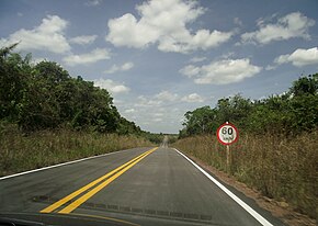
BR-401 is a federal highway in the state of Roraima in Brazil. The 202.9 km (126.1 mi) road[1] connects Boa Vista with Normandia and the road network of Guyana.[2][3]
The Ponte dos Macuxis [pt] over the Branco River was completed on 29 August 1975.[4] The Takutu River Bridge was completed in 2009, and provides access to the road network of Guyana.[5] The bridge switches between left- and right-hand drive automatically.[6]
In 2018, the section between Boa Vista and the border with Guyana was fully paved.[2] As of 2020, a section of almost 80 kilometres between Bonfim and Normandia is still unpaved.[3]
References
- ^ a b "BR-401" (PDF) (in Portuguese). Ministry of Transport. Archived from the original (PDF) on 12 December 2018. Retrieved 9 April 2021.
- ^ a b "BR-401, em Roraima, ganha mais um trecho restaurado e qualificado" (in Portuguese). Ministry of Transport Brazil. Retrieved 9 April 2021.
- ^ a b "Produtores reclamam das condições de trecho da BR-401". Boa Vistaja (in Portuguese). Retrieved 9 April 2021.
- ^ "Ponte dos Macuxis em Boa Vista". Viaja Brasil (in Portuguese). Retrieved 9 April 2021.
- ^ "Takutu Bridge to open Friday". Kaieteur News Online. Retrieved 9 April 2021.
- ^ "Takutu River Bridge – Guyana's Border – Brazil". Guyana South America. Retrieved 9 April 2021.
External links
 Media related to BR-401 at Wikimedia Commons
- v
- t
- e

- 010 (Rodovia Engenheiro Bernardo Sayão)
- 020
- 030
- 040
- 050
- 060
- 070
- 080
- 090
- 101 (Translitorânea/Rodovia Governador Mário Covas)
- 104
- 110
- 116 (Rodovia Presidente Dutra)
- 120
- 122
- 135
- 146
- 153 (Rodovia Transbrasiliana)
- 154
- 156
- 158
- 163
- 174
- 210
- 222
- 226
- 230
- 232
- 235
- 242
- 251
- 259
- 262
- 265
- 267
- 272
- 277
- 280
- 282
- 283
- 285
- 287 (Rodovia da Integração)
- 290 (Rodovia Osvaldo Aranha)
- 293
- 304
- 307
- 308
- 316
- 317
- 319
- 324
- 330
- 342
- 343
- 349
- 352
- 354
- 356
- 359
- 361
- 363
- 364
- 365
- 367
- 369
- 373
- 374
- 376
- 377
- 381 (Rodovia Fernão Dias)
- 383
- 386
- 392
- 393
- 401
- 402
- 403
- 404
- 405
- 406
- 407
- 408
- 409
- 410
- 411
- 412
- 413
- 414
- 415
- 416
- 417
- 418
- 419
- 420
- 421
- 422
- 423
- 424
- 425
- 426
- 427
- 428
- 429
- 430
- 431
- 432
- 433
- 434
- 437
- 448
- 450
- 451
- 452
- 453 (Rota do Sol)
- 454
- 455
- 456
- 457
- 458
- 459
- 460
- 461
- 462
- 463
- 464
- 465
- 466
- 467
- 468
- 469
- 470
- 471
- 472
- 473
- 474
- 475
- 476
- 477
- 478
- 479
- 480
- 481
- 482
- 483
- 484
- 485
- 486
- 487
- 488
- 489
- 490
- 491
- 492
- 493
- 494
- 495
- 496
- 497
- 498
- 499
- 600
- 610
  | This article about the roads and road transport of Brazil is a stub. You can help Wikipedia by expanding it. |
- v
- t
- e


