Barlow, Ohio
Unincorporated community in Ohio, U.S.
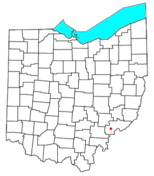
Barlow is an unincorporated community in western Barlow Township, Washington County, Ohio, United States.[1] Although it is unincorporated, it has a ZIP code 45712.[2] It lies at the intersection of State Routes 339 and 550 near the South Fork of Wolf Creek, which meets the Muskingum River at Waterford to the north.[3]
History
Barlow was platted in 1840.[4]
Education
Barlow has a public library, a branch of the Washington County Public Library.[5]
References
- ^ U.S. Geological Survey Geographic Names Information System: Barlow, Ohio
- ^ Zip Code Lookup Archived October 8, 2007, at the Wayback Machine
- ^ DeLorme, Ohio Atlas & Gazetteer, 7th ed., 2004, pp. 71, 81, ISBN 0-89933-281-1
- ^ History of Washington County, Ohio: With Illustrations and Biographical Sketches. H.Z. Williams. 1881. p. 718.
- ^ "Hours & Locations". Washington County Public Library. Archived from the original on March 3, 2018. Retrieved March 3, 2018.
- v
- t
- e
Municipalities and communities of Washington County, Ohio, United States
County seat: Marietta
- Belpre
- Marietta

- Beverly
- Lowell
- Lower Salem
- Macksburg
- Matamoras
communities
- Archers Fork
- Barlow
- Bartlett
- Beavertown
- Beckett
- Bevan
- Bloomfield
- Bonn
- Briggs
- Caywood
- Churchtown
- Coal Run
- Constitution
- Cornerville
- Cow Run
- Cutler
- Dalzell
- Dart
- Decaturville
- Deucher
- Dunbar
- Dunham
- Elba
- Equity
- Fifteen
- Fillmore
- Fleming
- Germantown
- Gracey
- Grandview
- Layman
- Leith
- Lower Newport
- Luke Chute
- Moore Junction
- Moss Run
- Newell Run
- Oak Grove
- Patten Mills
- Pinehurst
- Qualey
- Rainbow
- Relief
- Sitka
- Stanleyville
- Tick Ridge
- Veto
- Wade
- Warner
- Watertown
- Whipple
- Wingett Run
- Yankeeburg
- Ohio portal
- United States portal
39°23′55″N 81°39′53″W / 39.39861°N 81.66472°W / 39.39861; -81.66472
 | This Washington County, Ohio state location article is a stub. You can help Wikipedia by expanding it. |
- v
- t
- e


