Belá (river)
River
| Belá | |
|---|---|
 | |
| Physical characteristics | |
| Source | |
| • location | High Tatra |
| Mouth | |
• location | Váh in Liptovský Hrádok |
• coordinates | 49°02′06″N 19°42′36″E / 49.0349°N 19.7101°E / 49.0349; 19.7101 |
| Length | 23 km (14 mi) |
| Basin size | 244 km2 (94 sq mi) |
| Basin features | |
| Progression | Váh→ Danube→ Black Sea |
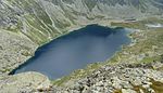
The Belá (Hungarian: Béla-patak), 22 kilometres (14 mi) in length, is a mountainous stream draining the headwaters of the Váh River basin in Tatra National Park, northern Slovakia.[1] It is a right tributary, into which it flows at the town of Liptovský Hrádok. The Belá itself is formed by two tributaries, the streams Tichý potok and Kôprovský potok, whose sources are in the High Tatra mountains, and which have their confluence near Podbanské, part of the town of Vysoké Tatry. It is 23 km (14 mi) long and its basin size is 244 km2 (94 sq mi).[2]

The Belá is well suited to rafting and kayaking.[3]
References
- ^ Pekárová P, Miklánek P (2011). "Long-term trend and multi-annual variability of water temperature in the pristine Bela River basin (Slovakia)". Journal of Hydrology. 400 (3–4): 333–340. Bibcode:2011JHyd..400..333P. doi:10.1016/j.jhydrol.2011.01.048.
- ^ Plán manažmentu povodňového rizikavčiastkovom povodí Váhu, p. 71
- ^ rivers.raft.cz Archived March 28, 2013, at the Wayback Machine, retrieved 17 May 2012
- v
- t
- e
Hydrography of Slovakia
| Black Sea basin |
| ||||
|---|---|---|---|---|---|
| Baltic Sea basin |
|
| Tarns in Tatra Mountains | |
|---|---|
| Other natural lakes |
|
| Váh basin |
|
|---|---|
| Other |
|
| Authority control databases: National |
|
|---|
This article related to a river in Slovakia is a stub. You can help Wikipedia by expanding it. |
- v
- t
- e


