Bocanda
Place in Lacs, Ivory Coast
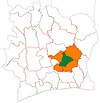
7°4′N 4°30′W / 7.067°N 4.500°W / 7.067; -4.500 Ivory Coast
 (2014)[1]
Bocanda is a town in east-central Ivory Coast. It is a sub-prefecture of and seat of Bocanda Department in N'Zi Region, Lacs District. Bocanda is also a commune.
The town has a small regional medical center, a mayor's office, an active marketplace, a petrol station, a high school, five primary schools, a Catholic church, several Protestant churches, and a mosque. The traditional residents are of the Baoulé tribe; however, there is also a large Dyula population.
In 2014, the population of the sub-prefecture of Bocanda was 60,183.[2]
Villages
The 56 villages of the sub-prefecture of Bocanda and their population in 2014 are:[2]
- Abo-N'guessankro (380)
- Abognikro (896)
- Aerokro (700)
- Ahali-Kolie-N'zikro (916)
- Akossikro (1,482)
- Amenankro (645)
- Andianou (884)
- Bocanda (10,684)
- Bokakro (229)
- Bombokro (1,625)
- Daouakro (1,437)
- Diakoubikro (212)
- Diakpo (615)
- Diango-Kokokro (871)
- Dida-Kayabo (1,607)
- Dida-Moessou (1,731)
- Djenzoukro (1,748)
- Fondi 1 (264)
- Fondi 2 (129)
- Gbanan-Koffikro (645)
- Gbonou (2,188)
- Gbonou-Carrefour (769)
- Goli (440)
- Golikro (625)
- Golikro N'zinouan (505)
- Kando-Koffikro (437)
- Kanoukro (738)
- Katchiré-Essékro (1,882)
- Koffi-Kouadiokro (810)
- Kokoboukro (237)
- Koliakro (911)
- Konan-Lekikro (674)
- Konan-N'drikro (1],461)
- Kotokounou (285)
- Kouadianikro (547)
- Koubikro (455)
- Koumokro (1,190)
- Kromikro (655)
- M'beri (621)
- N'da-Broukro (1,176)
- N'do-Kouassikro (850)
- N'doli-Yebouekro (455)
- N'gatta - Yebouekro (1,201)
- N'gatta-Kokokro (1,122)
- N'gouanlate (805)
- Nangokro (1,806)
- Sale-Balekro (1,648)
- Soh-N'guessankro (722)
- Sokokro (1,404)
- Souamekro (786)
- Soungra-Katienou (409)
- Soussouyakro (998)
- Tagnakro (1,211)
- Tekikro (930)
- Toumounou 2 (270)
- Ya Kouassikro (1,260)
References
- ^ "Côte d'Ivoire". geohive.com. Retrieved 9 December 2015.
- ^ a b "RGPH 2014, Répertoire des localités, Région N'Zi" (PDF). ins.ci. Retrieved 5 August 2019.
- v
- t
- e
Departments and sub-prefectures of N'Zi Region, Lacs DistrictRegional seat: Dimbokro
- Bengassou
- Bocanda*
- Kouadioblékro
- N'Zécrézessou
* also a commune
 | This Lacs District location article is a stub. You can help Wikipedia by expanding it. |
- v
- t
- e


