Bonny Blue, Virginia
Unincorporated community in Virginia, United States
Unincorporated community in Virginia, United States
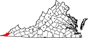
36°49′37″N 83°4′6″W / 36.82694°N 83.06833°W / 36.82694; -83.06833Bonny Blue is an unincorporated community and coal town in Lee County, Virginia, United States.
History
The community was likely named for the Bonnie Blue flag, the unofficial banner of the Confederacy at the start of the Civil War.[2] Bonny Blue contained a post office until 1962.[3]
References
- ^ U.S. Geological Survey Geographic Names Information System: Bonny Blue, Virginia
- ^ Tennis, Joe (2004). Southwest Virginia Crossroads: An Almanac of Place Names and Places to See. The Overmountain Press. p. 18. ISBN 978-1-57072-256-1.
- ^ "Lee County". Jim Forte Postal History. Archived from the original on October 6, 2014. Retrieved September 30, 2014.
- v
- t
- e
Municipalities and communities of Lee County, Virginia, United States
County seat: Jonesville
- Jonesville
- Pennington Gap
communities
- Benedict-Leona Mines
- Ben Hur
- Blackwater
- Bonny Blue
- Boons Path
- Buckles
- Bundy
- Calvin
- Caylor
- Darbyville
- Darnell Town
- Ely
- Fleenortown
- Gibson Station
- Goodloe
- Hagan
- Hubbard Springs
- Imperial
- Jasper
- Leona Mines
- Maness
- Mayflower
- Mohawk
- Monarch
- Ocoonita
- Olinger
- Penn Lee
- Rawhide
- Seminary
- Shepherd Hill
- Sigma
- Smiley
- Stone Creek
- Turners Siding
- Van
- Wheeler
- Woodway
- Virginia portal
- United States portal
 | This Lee County, Virginia state location article is a stub. You can help Wikipedia by expanding it. |
- v
- t
- e


