Breezy Path
Street in Hong Kong
Breezy Path (Chinese: 卑利士道) is a short and steep one-way road in the Mid-Levels, Hong Kong Island. It begins at the intersection point between Lyttleton Road and Park Road and ends at an intersection at Bonham Road.
Traffic can only travel downwards from Park Road to Bonham Road. There are no shops along the road; there are only residential buildings (Ying Piu Mansion) and the Hong Kong Institute of Technology. It provides a faster way to go from Lyttleton Road to Bonham Road and Caine Road, and some minibus routes use it as a shortcut, e.g. the number 56 route, which goes from Robinson Road to North Point.
The Hong Kong Institute of Technology building on Breezy Path is being demolished to make way for Ying Wa Girls' School's expansion.[1]
-
 Breezy Path
 -
 Institute of Technology
 -
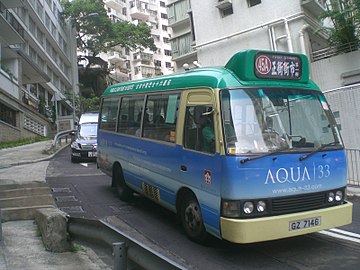 Minibus 45A
 -
 Stone wall
 -
 Ying Wah expansion
 -
 Sharp turn


References
- ^ "英華女校重建 活化歷史建築". Sina. 2012-09-10. Archived from the original on 2015-12-22.
Wikimedia Commons has media related to Breezy Path.
- v
- t
- e
Main borders and locations
- Central
- Admiralty
- Tamar
- τ
- Admiralty
- Mount Davis
- Glenealy
- Harcourt Road
- Kennedy Town
- Lung Fu Shan
- Mid-Levels
- The Peak
- Sai Ying Pun
- Shek Tong Tsui
- Sheung Wan
- Landmarks in Central
- Bank of America Tower
- Bonham Road
- British Consulate
- Breezy Path
- Central and Western Heritage Trail
- Civic Square
- First houses on the Peak
- Gate Lodge
- Grenville House
- Harcourt Garden
- Headquarters House
- High West
- Hong Kong Museum of Medical Sciences
- Hong Kong Zoological and Botanical Gardens
- Island Pacific Hotel
- King George V Memorial Park
- Lippo Centre
- Lung Fu Shan Country Park
- Mount Davis
- Mountain Lodge
- Ohel Leah Synagogue
- Old Tsan Yuk Maternity Hospital
- The Peak Galleria
- Hong Kong Trams Station (former)
- Pacific Place Phases I-II
- Peak Tower
- Queensway
- Sai Ying Pun Community Complex
- SoHo
- Shun Tak Centre
- South Korean Consulate
- Smithfield
- Tamar Park
- Tim Mei Avenue
- Tsan Yuk Hospital
- Victoria Peak Garden
| MTR stations |
|
|---|---|
| Ferry terminals | |
| Tram |
This list is incomplete. Central has its own template due to the number of sites in that area.
Sites specifically associated with University of Hong Kong are listed at the relevant template.
Sites specifically associated with University of Hong Kong are listed at the relevant template.
22°17′00″N 114°08′45″E / 22.283422°N 114.145790°E / 22.283422; 114.145790
 | This Hong Kong road article is a stub. You can help Wikipedia by expanding it. |
- v
- t
- e


