Canton of Wormhout
Canton in Hauts-de-France, France
Wormhout | |
|---|---|
Canton | |
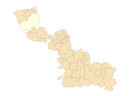 Map of the canton of Wormhout within the Nord department | |
| Country | France |
| Region | Hauts-de-France |
| Department | Nord |
| No. of communes | 45 |
| Seat | Wormhout |
| Area | 501.95 km2 (193.80 sq mi) |
| Population (2021)[1] | 53,803 |
| • Density | 107/km2 (280/sq mi) |
| INSEE code | 5941 |
Canton of Wormhout is an administrative division, located in Nord département and Hauts-de-France région in France. All communes of the canton of Wormhout are part of the arrondissement of Dunkirk.
Since the French canton reorganisation which came into effect in March 2015, the communes of the canton of Wormhout are:[2]
- Arnèke
- Bambecque
- Bavinchove
- Bissezeele
- Bollezeele
- Broxeele
- Buysscheure
- Crochte
- Eringhem
- Esquelbecq
- Hardifort
- Herzeele
- Holque
- Hondschoote
- Houtkerque
- Hoymille
- Killem
- Lederzeele
- Ledringhem
- Merckeghem
- Millam
- Nieurlet
- Noordpeene
- Ochtezeele
- Oost-Cappel
- Oudezeele
- Quaëdypre
- Rexpoëde
- Rubrouck
- Saint-Momelin
- Socx
- Steenvoorde
- Terdeghem
- Volckerinckhove
- Warhem
- Watten
- Wemaers-Cappel
- West-Cappel
- Winnezeele
- Wormhout
- Wulverdinghe
- Wylder
- Zegerscappel
- Zermezeele
- Zuytpeene
References
- ^ "Téléchargement du fichier d'ensemble des populations légales en 2021" (in French). The National Institute of Statistics and Economic Studies. 28 December 2023.
- ^ Décret n° 2014-167 du 17 février 2014 portant délimitation des cantons dans le département du Nord
- v
- t
- e
Cantons of the Nord department 

- Aniche
- Annœullin
- Anzin
- Armentières
- Aulnoye-Aymeries
- Aulnoy-lez-Valenciennes
- Avesnes-sur-Helpe
- Bailleul
- Cambrai
- Le Cateau-Cambrésis
- Caudry
- Coudekerque-Branche
- Croix
- Denain
- Douai
- Dunkerque-1
- Dunkerque-2
- Faches-Thumesnil
- Fourmies
- Grande-Synthe
- Hazebrouck
- Lambersart
- Lille-1
- Lille-2
- Lille-3
- Lille-4
- Lille-5
- Lille-6
- Marly
- Maubeuge
- Orchies
- Roubaix-1
- Roubaix-2
- Saint-Amand-les-Eaux
- Sin-le-Noble
- Templeuve-en-Pévèle
- Tourcoing-1
- Tourcoing-2
- Valenciennes
- Villeneuve-d'Ascq
- Wormhout
50°51′20″N 2°22′20″E / 50.85556°N 2.37222°E / 50.85556; 2.37222
 | This Nord geographical article is a stub. You can help Wikipedia by expanding it. |
- v
- t
- e


