Caroebe
Municipality in North, Brazil

Flag

Seal

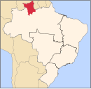
Location of Caroebe in the State of Roraima
 Brazil
 Roraima
 (2020 [1])
Caroebe (Portuguese pronunciation: [kaɾoˈɛbi]) is a municipality located in the southeast of the state of Roraima in Brazil. Its population is 10,383 (as of 2020) and its area is 12,066 km². It is the easternmost municipality in Roraima and the only one to border the state of Pará. Careoebe became an independent municipality in 1994.[3]
Climate
Caroebe has a tropical rainforest climate (Af) with moderate rainfall from September to March and heavy rainfall from April to August.
| Climate data for Caroebe | |||||||||||||
|---|---|---|---|---|---|---|---|---|---|---|---|---|---|
| Month | Jan | Feb | Mar | Apr | May | Jun | Jul | Aug | Sep | Oct | Nov | Dec | Year |
| Mean daily maximum °C (°F) | 31.8 (89.2) | 31.5 (88.7) | 31.5 (88.7) | 31.3 (88.3) | 30.8 (87.4) | 30.8 (87.4) | 31.3 (88.3) | 31.9 (89.4) | 32.7 (90.9) | 33.0 (91.4) | 32.7 (90.9) | 32.5 (90.5) | 31.8 (89.3) |
| Daily mean °C (°F) | 26.8 (80.2) | 26.8 (80.2) | 26.9 (80.4) | 26.9 (80.4) | 26.6 (79.9) | 26.2 (79.2) | 26.4 (79.5) | 26.8 (80.2) | 27.7 (81.9) | 27.7 (81.9) | 27.8 (82.0) | 27.4 (81.3) | 27.0 (80.6) |
| Mean daily minimum °C (°F) | 21.9 (71.4) | 22.2 (72.0) | 22.4 (72.3) | 22.6 (72.7) | 22.5 (72.5) | 21.6 (70.9) | 21.6 (70.9) | 21.8 (71.2) | 22.7 (72.9) | 22.5 (72.5) | 22.9 (73.2) | 22.4 (72.3) | 22.3 (72.1) |
| Average rainfall mm (inches) | 86 (3.4) | 86 (3.4) | 111 (4.4) | 203 (8.0) | 285 (11.2) | 271 (10.7) | 259 (10.2) | 160 (6.3) | 117 (4.6) | 108 (4.3) | 74 (2.9) | 100 (3.9) | 1,860 (73.3) |
| Source: Climate-Data.org[4] | |||||||||||||
References
External links
- Official website (in Portuguese)
 Media related to Caroebe at Wikimedia Commons
- v
- t
- e

Capital: Boa Vista
- Caroebe
- Rorainópolis
- São João da Baliza
- São Luiz
 | This Roraima, Brazil location article is a stub. You can help Wikipedia by expanding it. |
- v
- t
- e


