Družinska Vas
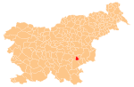
Place in Lower Carniola, Slovenia
45°51′38.47″N 15°15′25.82″E / 45.8606861°N 15.2571722°E / 45.8606861; 15.2571722 Slovenia
 (2002)
Družinska Vas (pronounced [dɾuˈʒiːnska ˈʋaːs]; Slovene: Družinska vas, German: Gesindeldorf[2]) is a village on the left bank of the Krka River in the Municipality of Šmarješke Toplice in southeastern Slovenia. The area is part of the historical region of Lower Carniola. The municipality is now included in the Southeast Slovenia Statistical Region.[3]
Name
Družinska Vas was attested in historical sources as Droschendorf in 1386 and Drosindorf in 1483. The name is derived from the nickname *Druganъ, presumably referring to an early inhabitant of the village, and therefore means 'Druganъ's village'.[4]
References
External links
- Družinska Vas on Geopedia
- v
- t
- e
Administrative seat: Šmarješke Toplice
| Current |
|
|---|---|
| Former |
|
- Šmarješke Toplice Spa
 | This article about the Municipality of Šmarješke Toplice in Slovenia is a stub. You can help Wikipedia by expanding it. |
- v
- t
- e


