Dzongka
Town in Tibet Autonomous Region of China
Town in Tibet, People's Republic of China
Dzongka 28°51′22″N 85°17′48″E / 28.8562°N 85.2966°E / 28.8562; 85.2966 | |
|---|---|
| Country | People's Republic of China |
| Autonomous region | Tibet |
| Prefecture-level city | Shigatse |
| County | Gyirong (Kyirong) |
 | |
Dzongka[1] (Tibetan: རྫོང་དགའ, Wylie: rdzong dga', THL: dzong ga) or Zongga (Chinese: 宗嘎镇; pinyin: Zōnggá Zhèn)[2] is a town and the administrative headquarters of Gyirong County[3] in the southwestern Tibet region of China bordering Nepal. Being the administrative headquarters, it is also sometimes referred to as "Gyirong Dzong" or "Gyirong Town", but it is different from the original Kyirong Town in the southern part of the county.
Dzongka and Gyirong County were on the ancient trade route between the Kathmandu Valley and Tibet. During the 18th century, the region faced an invasion from Nepal, which resulted in some destruction of the town.
Name
"Dzongka" means "mud wall" in Tibetan. The town had eight-metre-high mud walls around it, which is believed to have led to this popular name. The original name of the town, as well as the region, was Gungthang (var: Gungtang, Wylie: gung thang).[4][5]
Geography

Dzongka lies at an altitude of 4,130 metres (13,550 ft) in the valley of Kyirong Tsangpo near the confluence of its two source streams, Zarong Chu and Gyang Chu.[1][6]
The Kyirong Tsangpo valley, which continues into Nepal as the Trishuli River, has provided the ancient trade route between the Kathmandu valley and Tibet.
The Dzongka township contains six villages in addition to its own town community: Phula, Jiamu village, Gong village, Tsalung (Zalong), Xia village, and Orma (Woma village).[7]
History
Early and medieval

Dzongka was the capital of the kingdom of Gungthang, which covered the upper Kyirong Tsangpo valley (while Kyirong Town was the capital of Mangyul—the lower Kyirong valley).[8][9][10] The walled fortification of the town is said to have been built by a king named Chen Lhamchok De (gcen lha-mchog lde), often called Dolé.[11]
Gungthang, along with the neighbouring kingdom of Lo (now in Nepal), were regarded as part of Ngari Me ("Lower Ngari").[12][13][10][a] The entire Ngari region, which was originally part of the Zhangzhung kingdom, was conquered by Central Tibet around 645 AD.[14][12][b] In the 8th century, Indian Buddhist preachers such as Padmasambhava and Śāntarakṣita visited Tibet using the route through Nepal and Gungthang.[14][12]
By the 10th century, the Central Tibetan empire fragmented with rival factions fighting for power and regional power centres rising. In 910 AD, the Tibetan ruler Depal Khortsen was murdered, and his two sons fled to Ngari. The elder son, Kyide Nyimagon, went to establish a kingdom in Ngari To ("Upper Ngari") and the younger son, Tashi Tsekpa-pel (Bkra-shis-brtsegs-pa-dpal), came to Ngari Me, establishing the Gungthang kingdom at Dzongka.[15] The descendants of Tashi Tsekpa continued to rule Gungthang till the eventual absorption into Tsang in the 17th century.[16]
Milarepa (1040–1123), called Tibet's greatest poet-saint, was born at Tsalung, a village in the Dzongka township. He was a contemporary of the ruler Lhamchok De. Milarepa spent a good part of his life at Drakar Taso ("eagle's nest"), a hermitage on the border between Gungthang and Mangyul.[9][15]
In the late 12th century, a Gungthang princess was sent to Sakya as the third consort of Zangtsa Sonam Gyeltsen (zangs tsha bsod nams rgyal mtshan). This obtained for Gungthang the powerful protection of the Sakya hierarchs.[17] As the Sakya allied with the Mongols, Gungthang became an important power centre in Ngari.[18] In 1290, the forces of Kublai Khan fought those of the Chagatai Khanate at Dzongka over the control of Tibet, and defeated them.[19]
With the decline of Sakya and the Mongol Yuan dynasty, Gungthang's period of ascendance came to an end in the 14th century. For a time, Gungthang was eclipsed by Yatse, but it continued nevertheless with a reduced status.[20] In 1620, the kingdom was sacked by Tsang and became part of Central Tibet.[14] In 1642, the Ganden Phodrang administration under the Fifth Dalai Lama was established by the Mongols over the whole of Central Tibet.[21]
Modern
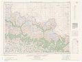
Maps

See also
Notes
- ^ The present day Ngari Prefecture of Tibet does not include Ngari Me.
- ^ Scholar David P. Jackson remarks that "Ngari" can be understood as "conquered land", perhaps a reference to this conquest.
References
- ^ a b Dorje 2004, p. 327.
- ^ "Geographical names of Tibet AR (China): Xigazê Prefecture-Level City". KNAB Place Name Database. Institute of the Estonian Language. 2018-06-03.
- ^ 2019年统计用区划代码和城乡划分代码:吉隆县. National Bureau of Statistics of the People's Republic of China.
- ^ Roberts 2000, pp. 165–166.
- ^ Ryavec 2015, p. 72, Map 17.
- ^ Tibetmap sheet 2885, Tibet Map Institute, retrieved 7 January 2023.
- ^ 2019年统计用区划代码和城乡划分代码:宗嘎镇. National Bureau of Statistics of the People's Republic of China. 2022.
- ^ Roberts 2000, p. 165.
- ^ a b Chan 1994, p. 924.
- ^ a b Ryavec 2015, p. 72, Map 17; p. 80, Map 20.
- ^ Roberts 2000, p. 166.
- ^ a b c Jackson 1976, p. 40.
- ^ Diemberger 2014, pp. 33–34.
- ^ a b c Diemberger 2014, p. 34.
- ^ a b Jackson 1976, p. 43.
- ^ Diemberger 2014, pp. 34–35.
- ^ Jackson 1976, p. 44.
- ^ Jackson 1976, p. 45.
- ^ Ryavec 2015, p. 86, Map 22.
- ^ Jackson 1976, p. 46.
- ^ Jigme N. Kazi (2020). Sons of Sikkim: The Rise and Fall of the Namgyal Dynasty of Sikkim. Notion Press. ISBN 978-1-64805-981-0.
Bibliography
- Chan, Victor (1994), Tibet Handbook, Moon Publications – via archive.org
- Diemberger, Hildegard (2014). When a Woman Becomes a Religious Dynasty: The Samding Dorje Phagmo of Tibet. Columbia University Press. ISBN 978-0-231-14321-9.
- Dorje, Gyurme (2004), Footprint Tibet Handbook with Bhutan (3rd ed.), Bath: Footprint Handbooks, ISBN 1-903471-30-3 – via archive.org
- Jackson, David P. (1976), "The early history of Lo (Mustang) and Ngari" (PDF), Journal of the Institute of Nepal and Asian Studies, 4 (1), Kathmandu: Tribhuvan University: 39–56
- Roberts, Peter Alan (2007). The Biographies of Rechungpa: The Evolution of a Tibetan Hagiography. Routledge. ISBN 978-1-135-98912-5.
- Roberts, Peter Alan (2000), The Biographies of Ras-chung-pa: The Evolution of a Tibetan Hagiography, University of Oxford
- Ryavec, Karl E. (2015), A Historical Atlas of Tibet, University of Chicago Press, ISBN 978-0-226-24394-8
External links
- v
- t
- e
- Gyangkar town
- Ri'og town
- Zhêntang town
- Dinggyê Township
- Dozhag Township
- Gojag Township
- Kyungzê Township
- Qab Township
- Sar Township
- Zhaxigang Township
- Gyangzê town
- Chêngring Township
- Dagzê Township
- Gyinkar Township
- Jagkyêr Township
- Jangra Township
- Kangcho Township
- Kardoi Township
- Karmai Township
- Lungmar Township
- Narong Township
- Nyangdoi Township
- Ralung Township
- Rasog Township
- Rinang Township
- Rixing Township
- Zangka Township
- Zhongzê Township
- Zêqên Township
- Dzongka town
- Kyirong Town
- Drakna Township
- Gungtang Township
- Trepa Township
- Salep Township
- Kamba town
- Changlung Township
- Kurmê Township
- Lungro Township
- Zhig Township
- Kangmar town
- Gala Township
- Kamru Township
- Nai'nying Township
- Nyingrungdoi Township
- Nyingrungmai Township
- Samarda Township
- Sapügang Township
- Xoinchêng Township
- Lhazê town
- Quxar town
- Chau Township
- Liu Township
- Mangpu Township
- Püncogling Township
- Qoima Township
- Rêsa Township
- Xiqên Township
- Zhaxigang Township
- Zhaxizom Township
- Namling town
- Car Township
- Dagna Township
- Dagzê Township
- Dobjoi Township
- Êma Township
- Gyamco Township
- Karzê Township
- Lhabupu Township
- Mangra Township
- Numa Township
- Pundam Township
- Qum Township
- Ratang Township
- Rindü Township
- Sogqên Township
- Tobgyai Township
- Kaika town
- Sangsang town
- Amxung Township
- Comai Township
- Dargyü Township
- Darog Township
- Dobê Township
- Goin'gyibug Township
- Kairag Township
- Kunglung Township
- Nyigo Township
- Qu'og Township
- Riwoqê Township
- Rusar Township
- Xungba Township
- Yamo Township
- Zazê Township
- Nyalam town
- Zham town
- Boro Township
- Mainpu Township
- Nailung Township
- Surco Township
- Yarlêb Township
- Dê'gyiling town
- Chagba Township
- Kangxung Township
- Moin Township
- Partang Township
- Pusum Township
- Qêwa Township
- Ramba Township
- Rinbung Township
- Gya'gya town
- Changgo Township
- Dênggar Township
- Lhagcang Township
- Ro'gyog Township
- Targyailing Township
- Xarru Township
- Xungru Township
- Gêding town
- Sa'gya town
- Chagjug Township
- Lalho Township
- Mabja Township
- Molha Township
- Sai Township
- Xaigar Township
- Xongma Township
- Xongmai Township
- Zhaxigang Township
- Ganggar town
- Xêgar town
- Chamso Township
- Cogo Township
- Gyaco Township
- Nyixar Township
- Kaimar Township
- Painji Township
- Qudêng Township
- Qulho Township
- Rongxar Township
- Zagor Township
- Zhaxizom Township
- Kagar town
- Capu Township
- Chuzhig Township
- Cobxi Township
- Dagmoxar Township
- Danagpu Township
- Lêba Township
- Moibaqêqên Township
- Namoqê Township
- Nartang Township
- Nyangra Township
- Qêqung Township
- Qingdü Township
- Rinqênzê Township
- Rungma Township
- Tarding Township
- Tongmoin Township
- Zêxoi Township
- Pagri town
- Xarsingma town
- Gyêru Township
- Kambu Township
- Shangyadong Township
- Tüna Township
- Xiayadong Township
- Paryang town
- Bodoi Township
- Gêla Township
- Gyêma Township
- Horba Township
- Labrang Township
- Lunggar Township
- Nagqu Township
- Painqi Township
- Parjang Township
- Rintor Township
- Yagra Township
- Qonkor Township


