Farrell Flat
Town in South Australia
33°50′0″S 138°48′0″E / 33.83333°S 138.80000°E / -33.83333; 138.80000- 151 km (94 mi) N of Adelaide
- 20 km (12 mi) E of Clare
- 22 km (14 mi) SW of Burra
| Localities around Farrell Flat: | ||
| Hill River | Gum Creek | Hanson |
| Clare | Farrell Flat | Porter Lagoon |
| Mintaro | Manoora | Black Springs |
Farrell Flat (formerly Hanson)[2] is a town in South Australia. The town is located 20 kilometres (12 mi) east of Clare and 22 kilometres (14 mi) southwest of Burra.

Once the heart of a thriving farming community, Farrell Flat today is largely a satellite town to the larger towns nearby. It has retained its own identity, with a functioning hotel, cafe and meeting house, engineering business and grain silos.
The town was surveyed as Hanson in 1870 and did not officially become Farrell Flat until 19 September 1940.[3] The name Farrell's Flat had been in use for some time, this being the name of the railway station.[4] The nearby town of Davies was officially renamed to Hanson on 19 September 1940.[4]
Farrell Flat was on the Roseworthy-Peterborough railway line. The last train ran through Farrell Flat in 2004.
Farrell Flat was named for Colonial Chaplain and Dean of Adelaide, James Farrell (26 November 1803 – 26 April 1869)

See also
Gallery
-
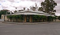 Farrell Flat Hotel in 2013
 -
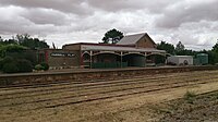 Farrell Flat Railway Station in 2013
 -
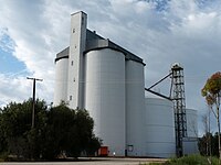 Silos
Silos -
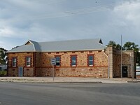 Farrell Flat Institute 1912
 -
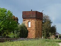 Railway Water Tank


References
- ^ Australian Bureau of Statistics (28 June 2022). "Farrell Flat (suburb and locality)". Australian Census 2021 QuickStats. Retrieved 28 June 2022.

- ^ Farrell Flat Archived 1 April 2018 at the Wayback Machine. South Australian History. Retrieved 1 April 2018.
- ^ "NEW TOWN NAMES APPROVED". The Advertiser. South Australia. 26 July 1940. p. 10. Retrieved 5 September 2016 – via National Library of Australia.
- ^ a b Towns and other places in the District, www.burrahistory.info Retrieved on 8 November 2014
- v
- t
- e
Towns and localities of the Regional Council of Goyder
- Apoinga
- Australia Plains
- Baldina
- Booborowie
- Bower
- Brady Creek
- Bright
- Brownlow
- Buchanan
- Bundey
- Burra
- Burra Eastern Districts
- Canowie
- Canowie Belt
- Collinsville
- Dutton (part)
- Emu Downs
- Eudunda
- Farrell Flat
- Franklyn
- Frankton
- Geranium Plains
- Gum Creek
- Hallelujah Hills
- Hallett
- Hampden
- Hansborough
- Hanson
- Julia
- Koonoona
- Leighton
- Mongolata
- Mount Bryan
- Mount Bryan East
- Neales Flat
- Ngapala
- North Booborowie
- Peep Hill
- Pine Creek
- Point Pass
- Porter Lagoon
- Robertstown
- Rocky Plain
- Steinfeld
- Sutherlands
- Terowie
- Ulooloo
- Whyte Yarcowie
- Willalo
- Wonna
- Worlds End
 | This South Australia geography article is a stub. You can help Wikipedia by expanding it. |
- v
- t
- e


