Harmancık
District and municipality in Bursa, Turkey
39°40′34″N 29°09′19″E / 39.67611°N 29.15528°E / 39.67611; 29.15528 (2022)[1]
Harmancık is a municipality and district of Bursa Province, Turkey.[2] Its area is 400 km2,[3] and its population is 5,979 (2022).[1]
Composition
There are 31 neighbourhoods in Harmancık District:[4]
- Akpınar
- Alutça
- Balatdanişment
- Ballısaray
- Bekdemirler
- Çakmak
- Çamoğlu
- Çatalsöğüt
- Dedebalı
- Delicegüney
- Dutluca
- Ece
- Gedikören
- Gökçeler
- Gülözü
- Harmancıkakalan
- Hobandanişment
- Ilıcaksu
- İshaklar
- Karaca
- Kepekdere
- Kıçmanlar
- Kılavuzlar
- Kocapınar
- Kozluca
- Merkez
- Nalbant
- Okçular
- Saçaklı
- Yayabaşı
- Yeşilyurt
References
- ^ a b "Address-based population registration system (ADNKS) results dated 31 December 2022, Favorite Reports" (XLS). TÜİK. Retrieved 12 July 2023.
- ^ Büyükşehir İlçe Belediyesi, Turkey Civil Administration Departments Inventory. Retrieved 12 July 2023.
- ^ "İl ve İlçe Yüz ölçümleri". General Directorate of Mapping. Retrieved 12 July 2023.
- ^ Mahalle, Turkey Civil Administration Departments Inventory. Retrieved 12 July 2023.
- v
- t
- e
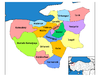
Harmancık in Bursa Province of Turkey

| Istanbul | |
|---|---|
| West Marmara | |
| Aegean | |
| East Marmara | |
| West Anatolia | |
| Mediterranean | |
| Central Anatolia | |
| West Black Sea | |
| East Black Sea | |
| Northeast Anatolia | |
| Central East Anatolia | |
| Southeast Anatolia | |
Metropolitan municipalities are bolded.
 | This geographical article about a location in Bursa Province, Turkey is a stub. You can help Wikipedia by expanding it. |
- v
- t
- e


