Houtteville

Part of Picauville in Normandy, France
Location of Houtteville
Map
49°20′21″N 1°21′39″W / 49.3392°N 1.3608°W / 49.3392; -1.3608CountryFranceRegionNormandyDepartmentMancheArrondissementCherbourgCantonCarentanCommunePicauville Area
1
4.51 km2 (1.74 sq mi)Population
 (2019)[1]
70 • Density16/km2 (40/sq mi)DemonymHouttevillaisTime zoneUTC+01:00 (CET) • Summer (DST)UTC+02:00 (CEST)Postal code
50250
Elevation1–37 m (3.3–121.4 ft)
(avg. 120 m or 390 ft)1 French Land Register data, which excludes lakes, ponds, glaciers > 1 km2 (0.386 sq mi or 247 acres) and river estuaries.

Houtteville (French pronunciation: [utvil]) is a former commune in the Manche department in north-western France. On 1 January 2016, it was merged into the commune of Picauville.[2]

Heraldry

Arms of Houtteville
Arms of Houtteville
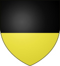
The arms of Houtteville are blazoned :
Per fess, sable and Or.


See also

References

  1. ^ Téléchargement du fichier d'ensemble des populations légales en 2019, INSEE
  2. ^ Arrêté préfectoral 23 December 2015 (in French)
Wikimedia Commons has media related to Houtteville.


Authority control databases: National Edit this at Wikidata
  • France
  • BnF data


  • v
  • t
  • e