Kurumayama


Kurumayama
Location of Mount Kuruma in Japan
Show map of Japan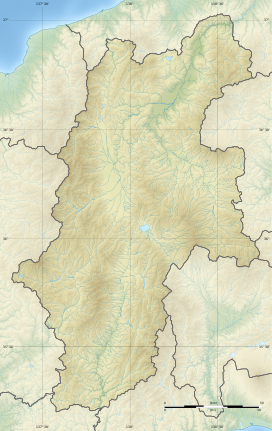
Kurumayama
Kurumayama (Nagano Prefecture)
Show map of Nagano PrefectureKurumayama (車山) is mountain in Nagano Prefecture, Japan. A part of the Kirigamine volcano and is the highest point.
The north-west side is covered with forest. The south-east side of Kurumayama is grassy which allows easy paragliding. The car access to the bottom of Kurumayama does not require the four-wheel drive, but at heavy snow, snow chains may help a lot.
-
 East side of Kurumayama
 -
 January
 -
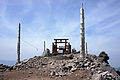 Small Shinto shrine on the summit
 -
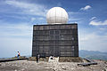 JMA's weather radar on the summit
 -
![East view from the top of Mount Kuruma. Lake Shirakaba [ja] in the center. Mount Tateshina in the background.](//upload.wikimedia.org/wikipedia/commons/thumb/1/1b/Tateshina07.JPG/120px-Tateshina07.JPG) East view from the top of Mount Kuruma. Lake Shirakaba [ja] in the center. Mount Tateshina in the background.
East view from the top of Mount Kuruma. Lake Shirakaba [ja] in the center. Mount Tateshina in the background.


![East view from the top of Mount Kuruma. Lake Shirakaba [ja] in the center. Mount Tateshina in the background.](http://upload.wikimedia.org/wikipedia/commons/thumb/1/1b/Tateshina07.JPG/120px-Tateshina07.JPG)
References
- ^ Geospatial Information Authority of Japan
36°06′10″N 138°11′47″E / 36.10278°N 138.19639°E / 36.10278; 138.19639


