La Tola
Municipality and town in Nariño Department, Colombia

Flag
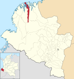
Location of the municipality and town of La Tola in the Nariño Department of Colombia.
 Colombia
[1]
(Census 2018[2])
La Tola is a town and municipality in the Nariño Department, Colombia.
Climate
La Tola has a tropical rainforest climate (Köppen Af) with heavy to very heavy rainfall year-round.
| Climate data for La Tola | |||||||||||||
|---|---|---|---|---|---|---|---|---|---|---|---|---|---|
| Month | Jan | Feb | Mar | Apr | May | Jun | Jul | Aug | Sep | Oct | Nov | Dec | Year |
| Mean daily maximum °C (°F) | 28.9 (84.0) | 29.9 (85.8) | 30.3 (86.5) | 30.0 (86.0) | 29.9 (85.8) | 29.9 (85.8) | 29.7 (85.5) | 29.5 (85.1) | 29.2 (84.6) | 28.6 (83.5) | 28.7 (83.7) | 29.1 (84.4) | 29.5 (85.1) |
| Daily mean °C (°F) | 25.6 (78.1) | 26.1 (79.0) | 26.4 (79.5) | 26.3 (79.3) | 26.4 (79.5) | 26.1 (79.0) | 26.0 (78.8) | 25.9 (78.6) | 25.8 (78.4) | 25.7 (78.3) | 25.7 (78.3) | 25.7 (78.3) | 26.0 (78.8) |
| Mean daily minimum °C (°F) | 22.4 (72.3) | 22.3 (72.1) | 22.5 (72.5) | 22.7 (72.9) | 22.9 (73.2) | 22.3 (72.1) | 22.3 (72.1) | 22.4 (72.3) | 22.4 (72.3) | 22.8 (73.0) | 22.7 (72.9) | 22.3 (72.1) | 22.5 (72.5) |
| Average rainfall mm (inches) | 331 (13.0) | 300 (11.8) | 263 (10.4) | 349 (13.7) | 521 (20.5) | 492 (19.4) | 335 (13.2) | 295 (11.6) | 375 (14.8) | 361 (14.2) | 280 (11.0) | 254 (10.0) | 4,156 (163.6) |
| Source: Climate-Data.org[3] | |||||||||||||
References
- v
- t
- e
Municipalities in the Nariño Department
- Albán
- Aldana
- Ancuya
- Arboleda
- Barbacoas
- Belén
- Buesaco
- Chachagüí
- Colón (Génova)
- Consaca
- Contadero
- Córdoba
- Cuaspud
- Cumbal
- Cumbitara
- El Charco
- El Peñol
- El Rosario
- El Tablón
- El Tambo
- Francisco Pizarro
- Funes
- Guachucal
- Guaitarilla
- Gualmatán
- Iles
- Imués
- Ipiales
- La Cruz
- La Florida
- La Llanada
- La Tola
- La Unión
- Leiva
- Linares
- Los Andes
- Magüí Payán
- Mallama
- Mosquera
- Nariño
- Olaya Herrera
- Ospina
- Pasto
- Policarpa
- Potosí
- Providencia
- Puerres
- Pupiales
- Ricaurte
- Roberto Payán
- Samaniego
- San Bernardo
- Sandona
- San Lorenzo
- San Pablo
- San Pedro de Cartago
- Santa Barbara
- Santacruz
- Sapuyes
- Taminango
- Tangua
- Tumaco
- Tuquerres
- Yacuanquer

2°25′N 78°15′W / 2.417°N 78.250°W / 2.417; -78.250
 | This Department of Nariño location article is a stub. You can help Wikipedia by expanding it. |
- v
- t
- e


