List of Pennsylvania state historical markers in Lehigh County
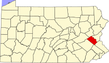
This is a list of the Pennsylvania state historical markers in Lehigh County.
This is intended to be a complete list of the official state historical markers placed in Lehigh County, Pennsylvania by the Pennsylvania Historical and Museum Commission (PHMC). The locations of the historical markers, as well as the latitude and longitude coordinates as provided by the PHMC's database, are included below when available. There are 29 historical markers located in Lehigh County.[1]
Map all coordinates using OpenStreetMap
Download coordinates as:
- KML
- GPX (all coordinates)
- GPX (primary coordinates)
- GPX (secondary coordinates)
Historical markers
| Marker title | Image | Date dedicated | Location | Marker type | Topics |
|---|---|---|---|---|---|
| Abraham Blumer - PLAQUE | November 1, 1929 | On grounds of Jordan United Church of Christ at Walbert, South Whitehall Twp. 40°36′49″N 75°34′01″W / 40.61352°N 75.567°W / 40.61352; -75.567 (Abraham Blumer - PLAQUE) | Plaque | American Revolution, Ethnic & Immigration, Military, Religion | |
| Allentown |  | September 3, 1947 | S 4th St. (PA 145), just S of W Mountain Rd., Allentown | Roadside | Business & Industry, Cities & Towns, Government & Politics 18th Century |
| Allentown |  | September 3, 1947 | MacArthur Rd. (PA 145) at N city line, just N of Sumner Ave. overpass, Allentown | Roadside | American Revolution, Business & Industry, Cities & Towns, Government & Politics |
| Allentown |  | September 3, 1947 | Tilghman St. (old US 22) at 30th St., Allentown 40°36′59″N 75°30′24″W / 40.6164°N 75.50678°W / 40.6164; -75.50678 (Allentown) | Roadside | American Revolution, Business & Industry, Cities & Towns, Government & Politics |
| Allentown |  | September 3, 1947 | N 19th St. at Roth Ave., Allentown | Roadside | American Revolution, Business & Industry, Cities & Towns, Government & Politics |
| Allentown |  | September 3, 1947 | U.S. 309 South at Allentown | Roadside | American Revolution, Business & Industry, Cities & Towns, Government & Politics |
| Biery's Port | April 24, 1988 | Corner Race & Lehigh Sts., Catasauqua | City | Business & Industry, Cities & Towns, Coal, Iron, Mills | |
| Crane Iron Works |  | May 4, 1997 | Front St. between Church & Wood Sts., Catasauqua 40°39′07″N 75°28′22″W / 40.65208°N 75.47287°W / 40.65208; -75.47287 (Crane Iron Works) | City | Business & Industry, Coal, Furnaces, Iron |
| David Thomas | May 20, 2001 | Pine Street, Catasauqua 40°39′18″N 75°28′28″W / 40.6551°N 75.47443°W / 40.6551; -75.47443 (David Thomas) | City | Business & Industry, Coal, Entrepreneurs, Ethnic & Immigration, Iron | |
| Dery Silk Mill |  | October 18, 1998 | 101 Race Street, Catasauqua 40°38′57″N 75°28′04″W / 40.64917°N 75.4677°W / 40.64917; -75.4677 (Dery Silk Mill) | City | Buildings, Business & Industry, Mills |
| Emmaus |  | July 26, 1966 | Main St. at library, Emmaus 40°32′28″N 75°29′12″W / 40.54103°N 75.48653°W / 40.54103; -75.48653 (Emmaus) | Roadside | Cities & Towns, Early Settlement, Native American, Religion |
| First Cement | September 2, 1947 | Opposite Coplay Cement office bldg. at Coplay 40°40′34″N 75°29′53″W / 40.67617°N 75.498°W / 40.67617; -75.498 (First Cement) | Roadside | Business & Industry | |
| First School Slate Factory | October 23, 2003 | Main and Factory Sts., Slatington 40°45′09″N 75°36′29″W / 40.75247°N 75.60805°W / 40.75247; -75.60805 (First School Slate Factory) | City | Business & Industry, Education | |
| Fort Deshler |  | October 7, 2001 | Pa. 145 at Ironton Rail Trail 40°40′20″N 75°30′58″W / 40.67227°N 75.51608°W / 40.67227; -75.51608 (Fort Deshler) | Roadside | Forts, French & Indian War, Military |
| Fort Everett | August 21, 1951 | Pa. 143 E of Lynnport 40°40′38″N 75°48′03″W / 40.67713°N 75.80095°W / 40.67713; -75.80095 (Fort Everett) | Roadside | Forts, French & Indian War, Military | |
| Frederick Leaser - PLAQUE | 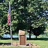 | November 1, 1928 | Leaser Lake Park off PA 143 via Pleasure Ct. (at end of parking lot at flag pole), Jacksonville 40°40′15″N 75°50′00″W / 40.67078°N 75.83333°W / 40.67078; -75.83333 (Frederick Leaser - PLAQUE) | Plaque | American Revolution |
| George Taylor (1716-1781) |  | n/a | Lehigh St. just S of Race St., Catasaqua 40°38′49″N 75°28′01″W / 40.64708°N 75.46683°W / 40.64708; -75.46683 (George Taylor) | City | Government & Politics, Government & Politics 18th Century, Iron |
| Harriet A. Baker | May 4, 1990 | 410 Union St., Allentown 40°36′03″N 75°27′51″W / 40.60095°N 75.4641°W / 40.60095; -75.4641 (Harriet A. Baker) | City | African American, Religion, Women | |
| Indian Jasper Quarries | October 23, 1952 | SR 2027 near intersection SR 2023, Vera Cruz 40°30′26″N 75°29′48″W / 40.50732°N 75.49672°W / 40.50732; -75.49672 (Indian Jasper Quarries) | City | Business & Industry, Native American | |
| Lehigh County |  | October 30, 1982 | Old Courthouse, 5th & Hamilton Sts., Allentown 40°36′12″N 75°28′05″W / 40.60333°N 75.46803°W / 40.60333; -75.46803 (Lehigh County) | City | Government & Politics, Government & Politics 19th Century |
| Lock Ridge Iron Furnace |  | September 7, 2009 | at Presbyterian church, 407 Franklin St. (at Church St.), Alburtis 40°30′33″N 75°35′54″W / 40.5093°N 75.5982°W / 40.5093; -75.5982 (Lock Ridge Iron Furnace) | Roadside | Coal, Furnaces, Iron |
| Portland Cement | November 4, 1947 | Iron Run Indus. Park., Tilghman St. (old U.S. 22), just W of Mill Rd. / Windsor Dr. intersection, W of Kuhnsville | Roadside | Business & Industry | |
| Samuel Wetherill (1821-1890) | September 23, 2003 | North side of Columbia between Webster and Adams Sts., Bethlehem 40°36′45″N 75°22′35″W / 40.61262°N 75.37651°W / 40.61262; -75.37651 (Samuel Wetherill) | City | Business & Industry, Civil War, Invention, Medicine & Science, Military | |
| Slate Industry |  | April 23, 2002 | Intersection of Main and Railroad Streets, Slatington 40°45′11″N 75°36′16″W / 40.75298°N 75.60452°W / 40.75298; -75.60452 (Slate Industry) | Roadside | Business & Industry, Entrepreneurs, Ethnic & Immigration |
| Stephen Vincent Benet |  | May 7, 1960 | NE corner, Ostrum & Bishopthorpe Sts., Fountain Hill 40°36′26″N 75°23′38″W / 40.60715°N 75.39382°W / 40.60715; -75.39382 (Stephen Vincent Benet) | City | Writers |
| Trout Hall | 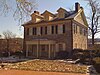 | January 24, 1967 | S. 4th St. near walnut St., Allentown 40°36′07″N 75°27′53″W / 40.60195°N 75.46467°W / 40.60195; -75.46467 (Trout Hall) | Roadside | Education, Government & Politics, Government & Politics 18th Century, Mansions & Manors, Religion |
| Troxell-Steckel House |  | November 2, 1970 | Main St. (PA 329) at Reliance St, beside church parking lot, Egypt 40°40′51″N 75°31′45″W / 40.68092°N 75.52908°W / 40.68092; -75.52908 (Troxell-Steckel House) | Roadside | Buildings, Early Settlement, Houses & Homesteads |
| Troxell-Steckel House | | November 2, 1970 | S Church St. (Rt. 1023) near Bridge St., Egypt 40°40′45″N 75°31′45″W / 40.67923°N 75.52917°W / 40.67923; -75.52917 (Troxell-Steckel House) | Roadside | Buildings, Early Settlement, Houses & Homesteads |
| Trucker's Mill | January 11, 1952 | Main St. (Pa. 873) near Diamond St., Slatington 40°45′10″N 75°36′38″W / 40.75278°N 75.61043°W / 40.75278; -75.61043 (Trucker's Mill) | City | Forts, French & Indian War, Military, Mills, Roads |
See also
 Pennsylvania portal

- List of Pennsylvania state historical markers
- National Register of Historic Places listings in Lehigh County, Pennsylvania
References
- ^ "Pennsylvania Historical Marker Search" (Searchable database). Pennsylvania Historical and Museum Commission. Commonwealth of Pennsylvania. Retrieved 2020-08-08.
External links
- Pennsylvania Historical Marker Program
- Pennsylvania Historical & Museum Commission
- v
- t
- e
Municipalities and communities of Lehigh County, Pennsylvania, United States
County seat: Allentown

communities
- Balliettsville
- Best Station
- Center Valley
- Colesville‡
- Eagle Point
- East Texas
- Emerald
- Fogelsville
- Friedensville
- Gauff Hill
- Germansville
- Hensingersville‡
- Hosensack
- Ironton
- Jacksonville
- Kuhnsville
- Lanark
- Limeport
- Locust Valley
- Lynnport
- Mickleys
- Neffs
- New Smithville
- Old Zionsville
- Orefield
- Pleasant Corners
- Powder Valley
- Scherersville
- Schoenersville‡
- Shimerville
- Sigmund
- Summit Lawn
- Vera Cruz
- Walbert
- Wanamakers
- Werleys Corner
- West Catasauqua
- Zionsville
‡This populated place also has portions in an adjacent county or counties
- Pennsylvania portal
- United States portal
| |
|---|---|
 Category Category |


