List of State Register of Heritage Places in the City of Vincent
Map all coordinates using OpenStreetMap
Download coordinates as:
- KML
- GPX (all coordinates)
- GPX (primary coordinates)
- GPX (secondary coordinates)
The State Register of Heritage Places is maintained by the Heritage Council of Western Australia. As of 2024[update], 425 places are heritage-listed in the City of Vincent,[1] of which 63 are on the State Register of Heritage Places.[2]
List
The Western Australian State Register of Heritage Places, as of 2024[update], lists the following 63 state registered places within the City of Vincent:
| Place name | Place # | Street number | Street name | Suburb or town | Co-ordinates | Notes & former names | Photo |
|---|---|---|---|---|---|---|---|
| Lindsay Street Flour Mill & Bakery Complex | 996 | 12 & 22 | Lindsay Street | Perth | 31°56′48″S 115°51′49″E / 31.946534°S 115.863702°E / -31.946534; 115.863702 (Lindsay Street Flour Mill & Bakery Complex) |  | |
| Baker's Terrace | 1000 | 156-184 | Lake Street | Perth | 31°56′36″S 115°51′36″E / 31.943277°S 115.859992°E / -31.943277; 115.859992 (Baker's Terrace) | 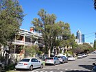 | |
| Brisbane Street Post Office | 1971 | 115 | Brisbane Street | Perth | 31°56′37″S 115°51′51″E / 31.943669°S 115.864239°E / -31.943669; 115.864239 (Brisbane Street Post Office) | North Perth Post Office | 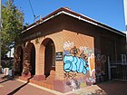 |
| Dilhorn House | 2168 | 2 | Bulwer Street | Perth | 31°56′32″S 115°52′01″E / 31.942312°S 115.866923°E / -31.942312; 115.866923 (Dilhorn House) | Army Museum, Loton House, Loton Park |  |
| St Alban's Church, Highgate | 2178 | 449 | Beaufort Street | Highgate | 31°56′25″S 115°52′05″E / 31.940261°S 115.867939°E / -31.940261; 115.867939 (St Alban's Church, Highgate) | 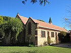 | |
| Highgate Primary School | 2180 | 147 | Lincoln Street | Perth | 31°56′28″S 115°51′59″E / 31.941145°S 115.866367°E / -31.941145; 115.866367 (Highgate Primary School) | 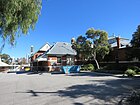 | |
| Sacred Heart Catholic Group, Highgate | 2181 | 40 | Mary Street | Highgate | 31°56′14″S 115°52′05″E / 31.937280°S 115.868147°E / -31.937280; 115.868147 (Sacred Heart Catholic Group, Highgate) | Consists of Monastery of Our Lady of the Sacred Heart (2182), Sacred Heart Church Hall (13034) and Sacred Heart Church (23930), |  |
| Monastery of Our Lady of the Sacred Heart (former) | 2182 | 42 | Mary Street | Highgate | 31°56′13″S 115°52′03″E / 31.937050°S 115.867581°E / -31.937050; 115.867581 (Monastery of Our Lady of the Sacred Heart) | Sacred Heart Convent (former), Sacred Heart Convent & School |  |
| St Mary's Catholic Church | 2196 | 40 | Franklin Street | Leederville | 31°55′37″S 115°50′35″E / 31.927039°S 115.843169°E / -31.927039; 115.843169 (St Mary's Catholic Church) |  | |
| St Mary's Hall | 2202 | 336 | Oxford Street | Leederville | 31°55′40″S 115°50′30″E / 31.927650°S 115.841569°E / -31.927650; 115.841569 (St Mary's Hall) |  | |
| Leederville Post Office | 2203 | 156 | Oxford Street | Leederville | 31°56′10″S 115°50′29″E / 31.936242°S 115.841455°E / -31.936242; 115.841455 (Leederville Post Office) |  | |
| North Perth Police Station | 2212 | 81 | Angove Street | North Perth | 31°55′45″S 115°51′20″E / 31.929281°S 115.855550°E / -31.929281; 115.855550 (North Perth Police Station) | North Perth Police Station and Quarters | 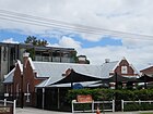 |
| North Perth Post Office (former) | 2215 | 21A | View Street | North Perth | 31°55′55″S 115°51′25″E / 31.931969°S 115.857039°E / -31.931969; 115.857039 (North Perth Post Office) |  | |
| North Perth Town Hall Complex | 2216 | 24 - 26 | View Street | North Perth | 31°55′53″S 115°51′24″E / 31.931448°S 115.856654°E / -31.931448; 115.856654 (North Perth Town Hall Complex) | North Perth Lesser Hall, North Perth Main Hall |  |
| Redemptorist Monastery and Church | 2218 | 190 | Vincent Street | North Perth | 31°56′09″S 115°51′23″E / 31.935833°S 115.856389°E / -31.935833; 115.856389 (Redemptorist Monastery and Church) |  | |
| Charles St Methodist Mission Chapel & Methodist Church | 2237 | 113 | Charles Street | West Perth | 31°56′29″S 115°51′06″E / 31.941401°S 115.851712°E / -31.941401; 115.851712 (Charles St Methodist Mission Chapel & Methodist Church) | Uniting Church and Methodist Mission Chapel, Wesleyan Church and Chapel (former) | 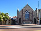 |
| Newcastle Street Government School | 2241 | 480 | Newcastle Street | West Perth | 31°56′29″S 115°51′04″E / 31.941290°S 115.851128°E / -31.941290; 115.851128 (Newcastle Street Government School) | Newcastle Street Infants & Seniors School, West Perth School, St Johns C of E School |  |
| Perth Oval | 2992 | 27 | Bulwer Street | Perth | 31°56′45″S 115°52′12″E / 31.945950°S 115.870131°E / -31.945950; 115.870131 (Perth Oval) | Loton Park, Members Equity Stadium, NIB Stadium |  |
| Throssell House, Perth | 2993 | 15 | Throssell Street | Perth | 31°56′13″S 115°51′34″E / 31.937050°S 115.859450°E / -31.937050; 115.859450 (Throssell House, Perth) | Wedderburn |  |
| Terrace Houses, 225-227 Beaufort Street | 3133 | 225 | Beaufort Street | Perth | 31°56′45″S 115°51′53″E / 31.945765°S 115.864680°E / -31.945765; 115.864680 (Terrace Houses, 225-227 Beaufort Street) | Two Terrace Houses |  |
| Terrace Houses, 235-241 Beaufort Street | 3134 | 235-241 | Beaufort Street | Perth | 31°56′44″S 115°51′53″E / 31.945468°S 115.864833°E / -31.945468; 115.864833 (Terrace Houses, 235-241 Beaufort Street) | Terrace Houses, Residences & Goodridge Galleries | 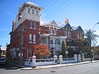 |
| Lincoln Street Ventilation Stack | 3137 | 57 | Lincoln Street | Highgate | 31°56′33″S 115°52′15″E / 31.942400°S 115.870800°E / -31.942400; 115.870800 (Lincoln Street Ventilation Stack) | Dumas' Folly |  |
| East Perth Power Station | 3318 | 11 | Summers Street | East Perth | 31°56′47″S 115°52′49″E / 31.946251°S 115.880239°E / -31.946251; 115.880239 (East Perth Power Station) |  | |
| Anzac Cottage | 3344 | 38 | Kalgoorlie Street | Mount Hawthorn | 31°55′25″S 115°50′05″E / 31.923499°S 115.834745°E / -31.923499; 115.834745 (Anzac Cottage) |  | |
| Shops, 452-460 William Street | 3485 | 452-460 | William Street | Perth | 31°56′36″S 115°51′48″E / 31.943221°S 115.863196°E / -31.943221; 115.863196 (Shops, 452-460 William Street) | 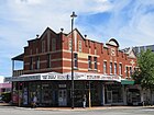 | |
| Loton Park Tennis Club | 3536 | Corner | Bulwer & Lord Streets | Perth | 31°56′43″S 115°52′18″E / 31.945261°S 115.871700°E / -31.945261; 115.871700 (Loton Park Tennis Club) | ||
| Beatty Park Leisure Centre & Beatty Park | 3553 | 220 | Vincent Street | North Perth | 31°56′08″S 115°50′56″E / 31.935556°S 115.848889°E / -31.935556; 115.848889 (Beatty Park Leisure Centre & Beatty Park) | Beatty Aquatic Centre, City of Perth Aquatic Centre | 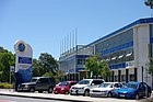 |
| Brookman & Moir Streets Precinct | 3992 | Moir & Brookman Streets & Forbes Road | Perth | 31°56′38″S 115°51′38″E / 31.943862°S 115.860685°E / -31.943862; 115.860685 (Brookman & Moir Streets Precinct) |  | ||
| Highgate Hill Police Station, Lockup & Quarters (former) | 4282 | 57 | Lincoln Street | Perth | 31°56′34″S 115°52′14″E / 31.942836°S 115.870636°E / -31.942836; 115.870636 (Highgate Hill Police Station, Lockup & Quarters) | Highgate Police Station, Lockup & Quarters | |
| Hyde Park | 4634 | Vincent Street | Highgate | 31°56′16″S 115°51′45″E / 31.937781°S 115.862500°E / -31.937781; 115.862500 (Hyde Park, Perth) | Third Swamp, Third Swamp Reserve | 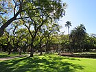 | |
| Maltings Plant (former) | 4648 | 33-35 | Stuart Street | Perth | 31°56′35″S 115°51′23″E / 31.943134°S 115.856521°E / -31.943134; 115.856521 (Maltings Plant) | Union Maltings, Union Brewery, Harwood's Brewery, Perth Pneumatic Maltings |  |
| Bowra and O'Dea Beaufort Street | 8586 | 359 | Beaufort Street | Perth | 31°56′32″S 115°52′01″E / 31.942244°S 115.866944°E / -31.942244; 115.866944 (Bowra and O'Dea Beaufort Street) | Pensioner Funeral Services, Arthur E. Davies & Co. |  |
| Robertson Park and Archaeological Sites | 8705 | 176 | Fitzgerald Street, Randell, Palmerston & Stuart Streets | Perth | 31°56′27″S 115°51′26″E / 31.940902°S 115.857185°E / -31.940902; 115.857185 (Robertson Park and Archaeological Sites) | Lake Henderson |  |
| Aranmore Catholic College Group | 8709 | 30-42 Franklin Street & 338-342 Shakespeare Street | Leederville | 31°55′40″S 115°50′35″E / 31.927694°S 115.843000°E / -31.927694; 115.843000 (Aranmore Catholic College Group) | Arranmore, St Mary's Convent and School, St Mary's College, Christian Brothers College | 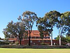 | |
| Stables (former), 17 Lindsay Street | 8723 | 15-17 | Lindsay Street | Perth | 31°56′46″S 115°51′48″E / 31.946189°S 115.863200°E / -31.946189; 115.863200 (Stables (former), 17 Lindsay Street) |  | |
| Mackays Aerated Waters Factory (former) | 8728 | Oct-22 | Money Street | Perth | 31°56′46″S 115°51′47″E / 31.945988°S 115.862940°E / -31.945988; 115.862940 (Mackays Aerated Waters Factory) | Chas Hopkins Office Interiors Bulkstores, Mackay & Co, Mackays Aerated Waters |  |
| Oddfellows Hall (former), Leederville | 8736 | 217 | Oxford Street | Leederville | 31°56′01″S 115°50′27″E / 31.933628°S 115.840938°E / -31.933628; 115.840938 (Oddfellows Hall, Leederville) | Oddfellows Hall, IOOF Buffaloes Lodge (former) | 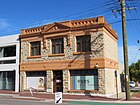 |
| Serbian Orthodox Church of St. Sava | 8746 | 31 | Smith Street | Highgate | 31°56′29″S 115°52′14″E / 31.941522°S 115.870564°E / -31.941522; 115.870564 (Serbian Orthodox Church of St. Sava) |  | |
| North Perth Fire Station (former) | 8749 | 21 | View Street | North Perth | 31°55′55″S 115°51′26″E / 31.932011°S 115.857200°E / -31.932011; 115.857200 (North Perth Fire Station) |  | |
| Drill Hall, Leederville | 8764 | 177 | Oxford Street | Leederville | 31°56′10″S 115°50′24″E / 31.936144°S 115.840135°E / -31.936144; 115.840135 (Drill Hall, Leederville) | RAAF Barracks & Drill Hall, Leederville Mechanics' Institute |  |
| Dwelling, Caretaker's House, Robertson Park | 11436 | 176 | Fitzgerald Street | North Perth | 31°56′28″S 115°51′21″E / 31.941147°S 115.855769°E / -31.941147; 115.855769 (Dwelling, Caretaker's House, Robertson Park) | Robertson Park & Associated Buildings | |
| Parry Street Precinct | 11543 | Parry Street & Pier Street | Perth | 31°56′54″S 115°52′02″E / 31.948233°S 115.867285°E / -31.948233; 115.867285 (Parry Street Precinct) | |||
| Sacred Heart Church Hall | 13034 | 42 | Mary Street | Highgate | 31°56′13″S 115°52′03″E / 31.937053°S 115.867584°E / -31.937053; 115.867584 (Sacred Heart Church Hall) |  | |
| Walcott Centre | 15731 | 3 | Walcott Street | Mount Lawley | 31°56′19″S 115°52′34″E / 31.938594°S 115.876186°E / -31.938594; 115.876186 (Walcott Centre) | Walcott Street Reception Home, Government Receiving Depot, Child Welfare Rec |  |
| Two Attached Houses | 15787 | 147-149 | Parry Street | Perth | 31°56′52″S 115°51′58″E / 31.947669°S 115.866181°E / -31.947669; 115.866181 (Two Attached Houses, 147-149 Parry Street) | ||
| House | 15788 | 145 | Parry Street | Perth | 31°56′53″S 115°52′02″E / 31.948180°S 115.867170°E / -31.948180; 115.867170 (House, 145 Parry Street) | ||
| Two Conjoined Houses | 15789 | 143 | Parry Street | Perth | 31°56′52″S 115°51′59″E / 31.947739°S 115.866361°E / -31.947739; 115.866361 (Two Conjoined Houses, 143 Parry Street) | ||
| Two Attached Houses | 15790 | 139-141 | Parry Street | Perth | 31°56′52″S 115°51′59″E / 31.947789°S 115.866461°E / -31.947789; 115.866461 (Two Attached Houses, 139-141 Parry Street) | ||
| Two Attached Houses | 15791 | 135-137 | Parry Street | Perth | 31°56′52″S 115°52′00″E / 31.947777°S 115.866646°E / -31.947777; 115.866646 (Two Attached Houses, 135-137 Parry Street) | ||
| House | 15793 | 111 | Parry Street | Perth | 31°56′52″S 115°51′59″E / 31.947650°S 115.866328°E / -31.947650; 115.866328 (House, 111 Parry Street) | ||
| Two Attached Houses | 15794 | 107-109 | Parry Street | Perth | 31°56′54″S 115°52′03″E / 31.948195°S 115.867470°E / -31.948195; 115.867470 (Two Attached Houses, 107-109 Parry Street) | ||
| Two Attached Houses | 15795 | 103-105 | Parry Street | Perth | 31°56′54″S 115°52′03″E / 31.948333°S 115.867565°E / -31.948333; 115.867565 (Two Attached Houses, 103-105 Parry Street) | ||
| Houses | 15796 | 99-101 | Parry Street | Perth | 31°56′54″S 115°52′04″E / 31.948361°S 115.867731°E / -31.948361; 115.867731 (Houses, 99-101 Parry Street) | ||
| Five Houses | 15797 | 85-93 | Parry Street | Perth | 31°56′54″S 115°52′05″E / 31.948460°S 115.867925°E / -31.948460; 115.867925 (Five Houses, 85-93 Parry Street) | ||
| House | 15798 | 89 | Parry Street | Perth | 31°56′55″S 115°52′05″E / 31.948492°S 115.867996°E / -31.948492; 115.867996 (House, 89 Parry Street) | ||
| North Perth Primary School | 16789 | 3 | Albert Street | North Perth | 31°55′50″S 115°51′21″E / 31.930627°S 115.855879°E / -31.930627; 115.855879 (North Perth Primary School) | School of Instrumental Music, North Perth Infants School, Toorak/Woodville PS |  |
| Tudor Lodge | 17150 | 57 & 59 | Chelmsford Road | Mount Lawley | 31°56′09″S 115°52′02″E / 31.935894°S 115.867214°E / -31.935894; 115.867214 (Tudor Lodge) | Mean-Myne, Tudor Lodge Family & Children's, Services Hostel |  |
| North Perth Town Hall - Lesser Hall | 18079 | 20-26 | View Street | North Perth | 31°55′53″S 115°51′24″E / 31.931449°S 115.856775°E / -31.931449; 115.856775 (North Perth Town Hall - Lesser Hall) |  | |
| North Perth Town Hall - Main Hall | 18080 | 20-26 | View Street | North Perth | 31°55′53″S 115°51′24″E / 31.931449°S 115.856775°E / -31.931449; 115.856775 (North Perth Town Hall - Main Hall) |  | |
| Sewerage Vent, Northbridge | 23777 | Stuart Street | Northbridge | 31°56′34″S 115°51′29″E / 31.942898°S 115.858066°E / -31.942898; 115.858066 (Sewerage Vent, Northbridge) | 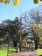 | ||
| Sewerage Vent, Hyde Park, Highgate | 23781 | William Street | Highgate | 31°56′23″S 115°51′51″E / 31.939793°S 115.864266°E / -31.939793; 115.864266 (Sewerage Vent, Hyde Park, Highgate) | 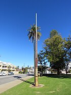 | ||
| Sacred Heart Church | 23930 | 40-42 | Mary Street | Highgate | 31°56′14″S 115°52′05″E / 31.937280°S 115.868147°E / -31.937280; 115.868147 (Sacred Heart Catholic Group, Highgate) | 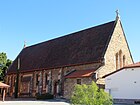 | |
| Metropolitan Sewerage Vents | 23992 | East & West Perth, Highgate, Northbridge | 31°56′34″S 115°51′29″E / 31.942898°S 115.858066°E / -31.942898; 115.858066 (Sewerage Vent, Northbridge)31°56′23″S 115°51′51″E / 31.939793°S 115.864266°E / -31.939793; 115.864266 (Sewerage Vent, Hyde Park, Highgate) |  |
References
- v
- t
- e
Heritage places of Western Australia by local government area
| Overview | |
|---|---|
| Cities | |
| Towns | |
| Shires | |
| Islands |
- Beverley
- Brookton†
- Bruce Rock
- Chittering
- Corrigin
- Cuballing
- Cunderdin
- Dalwallinu
- Dandaragan†
- Dowerin†
- Dumbleyung†
- Gingin
- Goomalling
- Kellerberrin
- Kondinin
- Koorda†
- Kulin
- Lake Grace
- Merredin
- Moora
- Mount Marshall†
- Mukinbudin†
- Narembeen
- Narrogin
- Northam
- Nungarin
- Pingelly
- Quairading
- Tammin†
- Toodyay
- Trayning
- Victoria Plains
- Wagin
- Wandering†
- West Arthur
- Westonia
- Wickepin
- Williams
- Wongan-Ballidu
- Wyalkatchem
- Yilgarn
- York (Town of York • Shire of York)
| Organisations | |
|---|---|
| Register |
| Current |
|
|---|---|
| Former | |
^† Denotes LGA without State Heritage Listed Places | |


