Looxahoma, Mississippi
Unincorporated community in Mississippi, United States
34°35′50″N 89°50′13″W / 34.59722°N 89.83694°W / 34.59722; -89.8369438668
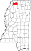
Looxahoma is an unincorporated community in Tate County, Mississippi, United States. Looxahoma is located approximately 8 miles (13 km) east of Senatobia and approximately 8 miles (13 km) west of Tyro near Mississippi Highway 4.
Looxahoma is a name derived from the Chickasaw language meaning "red turtle".[2]
References
Wikimedia Commons has media related to Looxahoma, Mississippi.
- v
- t
- e
Municipalities and communities of Tate County, Mississippi, United States
County seat: Senatobia
communities
- Cottonville
- Looxahoma
- Sarah
- Savage
- Thyatira
- Tyro
- Mississippi portal
- United States portal


 | This Tate County, Mississippi state location article is a stub. You can help Wikipedia by expanding it. |
- v
- t
- e


