Mường Nhé district
You can help expand this article with text translated from the corresponding article in Vietnamese. (March 2009) Click [show] for important translation instructions.
- View a machine-translated version of the Vietnamese article.
- Machine translation, like DeepL or Google Translate, is a useful starting point for translations, but translators must revise errors as necessary and confirm that the translation is accurate, rather than simply copy-pasting machine-translated text into the English Wikipedia.
- Do not translate text that appears unreliable or low-quality. If possible, verify the text with references provided in the foreign-language article.
- You must provide copyright attribution in the edit summary accompanying your translation by providing an interlanguage link to the source of your translation. A model attribution edit summary is
Content in this edit is translated from the existing Vietnamese Wikipedia article at [[:vi:Mường Nhé]]; see its history for attribution. - You may also add the template
{{Translated|vi|Mường Nhé}}to the talk page. - For more guidance, see Wikipedia:Translation.
District in Northwest, Vietnam
Mường Nhé District Huyện Mường Nhé | |
|---|---|
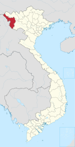
 District location in northern Vietnam | |
| Country |  Vietnam Vietnam |
| Region | Northwest |
| Province | Điện Biên |
| Capital | Mường Nhé |
| Area | |
| • Total | 607.62 sq mi (1,573.73 km2) |
| Population (2019 census) | |
| • Total | 45,727 |
| • Density | 75/sq mi (29/km2) |
| Time zone | UTC+07:00 (Indochina Time) |
Mường Nhé is a rural district of Điện Biên province in the Northwest region of Vietnam. As of 2019, the district had a population of 45,727.[1][2] The district covers an area of 1,573.73 km². The district capital lies at Mường Nhé commune.[2] It contains the 182,000 hectare Mường Nhé Nature Reserve.
On 25 August 2012, the eastern portion of the district was carved out to form Nậm Pồ district.
Geography
Administrative divisions
Mường Nhé district is divided into 11 rural communes, including:
- Chung Chải
- Huổi Lếch
- Leng Su Sìn
- Mường Nhé (district capital)
- Mường Toong
- Nậm Kè
- Nậm Vì
- Pá Mỳ
- Quảng Lâm
- Sen Thượng
- Sín Thầu
History
The district was established on 14 January 2002.
In late April 2011, 7,000 people, most of them ethnic Hmong Christians, demonstrated against the government in Huổi Khon and neighboring villages, some of whom were calling for an independent Hmong kingdom.[3] Police and army were quick to dissipate the unrest.[4][better source needed]
On 13 March 2012, eight ethnic Hmong men who allegedly traveled to Mường Nhé in 2011 to pray and await the arrival of a new king were jailed for up to 30 months, having been found guilty of "disturbing public order" by attempting to set up an independent Hmong kingdom in Mường Nhé. The government media claimed the culprits were illiterate and blamed the unrest to a "millenarian plot".[5]
References
- ^ "Mường Nhé (District, Điện Biên, Vietnam) - Population Statistics, Charts, Map and Location". www.citypopulation.de. Retrieved 2024-02-07.
- ^ a b "Districts of Vietnam". Statoids. Retrieved March 13, 2009.
- ^ "Thousands of Hmong stage rare Vietnam protest". Reuters. 2011-05-06. Archived from the original on March 1, 2016.
- ^ "Vietnam, Laos: Attack Helicopters Unleashed Death on Hmong". 2011-05-22.
- ^ "Vietnam jails eight for 'millenarian uprising'". Financial Times. 14 March 2012.
- v
- t
- e
Capital: Điện Biên Phủ
- Wards
- Him Lam
- Mường Thanh
- Nam Thanh
- Noong Bua
- Tân Thanh
- Thanh Bình
- Thanh Trường
- Communes
- Mường Phăng
- Nà Nhạn
- Nà Tấu
- Pá Khoang
- Thanh Minh
- Hẹ Muông
- Hua Thanh
- Mường Lói
- Mường Nhà
- Mường Pồn
- Na Tông
- Na Ư
- Noọng Hẹt
- Noong Luống
- Núa Ngam
- Pa Thơm
- Phu Luông
- Pom Lót
- Sam Mứn
- Thanh An
- Thanh Chăn
- Thanh Hưng
- Thanh Luông
- Thanh Nưa
- Thanh Xương
- Thanh Yên
- Mường Ảng
- Ẳng Cang
- Ẳng Nưa
- Ẳng Tở
- Búng Lao
- Mường Đăng
- Mường Lạn
- Nặm Lịch
- Ngối Cáy
- Xuân Lao
- Mường Chà
- Huổi Lèng
- Huổi Mí
- Hừa Ngài
- Ma Thì Hồ
- Mường Mươn
- Mường Tùng
- Na Sang
- Nậm Nèn
- Pa Ham
- Sa Lông
- Sá Tổng
- Tuần Giáo
- Chiềng Đông
- Chiềng Sinh
- Mường Khong
- Mường Mùn
- Mường Thín
- Nà Sáy
- Nà Tòng
- Phình Sáng
- Pú Nhung
- Pú Xi
- Quài Cang
- Quài Nưa
- Quài Tở
- Rạng Đông
- Ta Ma
- Tênh Phông
- Tỏa Tình
- Mùn Chung
Districts of Northwest Vietnam | ||
|---|---|---|
| Điện Biên province |
|  |
| Hòa Bình province | ||
| Lai Châu province | ||
| Lào Cai province | ||
| Sơn La province | ||
| Yên Bái province | ||
※ denotes provincial seat. | ||
22°11′30″N 102°27′20″E / 22.19167°N 102.45556°E / 22.19167; 102.45556


