Mancha Khiri district
District in Khon Kaen, Thailand
Mancha Khiri มัญจาคีรี | |
|---|---|
District | |
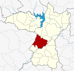 District location in Khon Kaen province | |
| Coordinates: 16°7′36″N 102°32′32″E / 16.12667°N 102.54222°E / 16.12667; 102.54222 | |
| Country | Thailand |
| Province | Khon Kaen |
| Seat | Kut Khao |
| Area | |
| • Total | 735.825 km2 (284.104 sq mi) |
| Population (2005) | |
| • Total | 72,244 |
| • Density | 98.2/km2 (254/sq mi) |
| Time zone | UTC+7 (ICT) |
| Postal code | 40160 |
| Geocode | 4017 |
Mancha Khiri (Thai: มัญจาคีรี, pronounced [mān.tɕāː khīː.rīː]; Northeastern Thai: มัญจาคีรี, pronounced [ma᷇n.tɕāː kʰi᷇ː.li᷇ː]) is a district (amphoe) in the southern part of Khon Kaen province, northeastern Thailand.
Geography
Neighboring districts are (from the north clockwise): Nong Ruea, Ban Fang, Phra Yuen, Ban Haet, Ban Phai, Chonnabot, Khok Pho Chai of Khon Kaen Province; Kaeng Khro and Ban Thaen of Chaiyaphum province.
History
The district was renamed from Kut Khao to Mancha Khiri in 1939.[1]
Administration
The district is divided into eight subdistricts (tambons), which are further subdivided into 116 villages (mubans). Mancha Khiri is a township (thesaban tambon) and covers parts of tambon Kut Khao. There are a further eight tambon administrative organizations (TAO).
| No. | Name | Thai name | Villages | Pop. | |
|---|---|---|---|---|---|
| 1. | Kut Khao | กุดเค้า | 17 | 12,775 | |
| 2. | Suan Mon | สวนหม่อน | 14 | 7,885 | |
| 3. | Nong Paen | หนองแปน | 16 | 9,109 | |
| 4. | Phon Phek | โพนเพ็ก | 14 | 7,957 | |
| 5. | Kham Khaen | คำแคน | 13 | 9,162 | |
| 6. | Na Kha | นาข่า | 17 | 9,919 | |
| 7. | Na Ngam | นางาม | 14 | 7,885 | |
| 10. | Tha Sala | ท่าศาลา | 11 | 7,552 |
Missing numbers belong to subdistricts which now form Khok Pho Chai District.
References
- ^ พระราชกฤษฎีกาเปลี่ยนนามอำเภอ กิ่งอำเภอ และตำบลบางแห่ง พุทธศักราช ๒๔๘๒ (PDF). Royal Gazette (in Thai). 56 (ก): 354–364. April 17, 1939. Archived from the original (PDF) on February 19, 2009.
External links
- amphoe.com
- v
- t
- e
 | This Khon Kaen Province location article is a stub. You can help Wikipedia by expanding it. |
- v
- t
- e


