Meleti
Comune in Lombardy, Italy
Meleti Melét (Lombard) | |
|---|---|
Comune | |
| Comune di Meleti | |
 | |
 Coat of arms | |
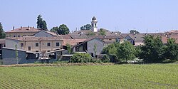
Location of Meleti  | |
45°10′N 9°51′E / 45.167°N 9.850°E / 45.167; 9.850 | |
| Country | Italy |
| Region | Lombardy |
| Province | Lodi (LO) |
| Government | |
| • Mayor | Mario Raffaele Rocca |
| Area [1] | |
| • Total | 7.39 km2 (2.85 sq mi) |
| Elevation | 40 m (130 ft) |
| Population (31 October 2017)[2] | |
| • Total | 446 |
| • Density | 60/km2 (160/sq mi) |
| Demonym | Meletesi |
| Time zone | UTC+1 (CET) |
| • Summer (DST) | UTC+2 (CEST) |
| Postal code | 26843 |
| Dialing code | 0377 |
| Website | Official website |
Meleti (Lodigiano: Melét; locally Mlìd) is a comune (municipality) in the Province of Lodi in the Italian region Lombardy, located about 60 kilometres (37 mi) southeast of Milan and about 30 kilometres (19 mi) southeast of Lodi.
Wikimedia Commons has media related to Meleti.
Meleti borders the following municipalities: Crotta d'Adda, Cornovecchio, Maccastorna, Castelnuovo Bocca d'Adda, Caselle Landi.
References
- v
- t
- e
- Abbadia Cerreto
- Bertonico
- Boffalora d'Adda
- Borghetto Lodigiano
- Borgo San Giovanni
- Brembio
- Casaletto Lodigiano
- Casalmaiocco
- Casalpusterlengo
- Caselle Landi
- Caselle Lurani
- Castelgerundo
- Castelnuovo Bocca d'Adda
- Castiglione d'Adda
- Castiraga Vidardo
- Cavenago d'Adda
- Cervignano d'Adda
- Codogno
- Comazzo
- Cornegliano Laudense
- Corno Giovine
- Cornovecchio
- Corte Palasio
- Crespiatica
- Fombio
- Galgagnano
- Graffignana
- Guardamiglio
- Livraga
- Lodi
- Lodi Vecchio
- Maccastorna
- Mairago
- Maleo
- Marudo
- Massalengo
- Meleti
- Merlino
- Montanaso Lombardo
- Mulazzano
- Orio Litta
- Ospedaletto Lodigiano
- Ossago Lodigiano
- Pieve Fissiraga
- Salerano sul Lambro
- San Fiorano
- San Martino in Strada
- San Rocco al Porto
- Sant'Angelo Lodigiano
- Santo Stefano Lodigiano
- Secugnago
- Senna Lodigiana
- Somaglia
- Sordio
- Tavazzano con Villavesco
- Terranova dei Passerini
- Turano Lodigiano
- Valera Fratta
- Villanova del Sillaro
- Zelo Buon Persico
| Authority control databases |
|
|---|
 | This article on a location in the Province of Lodi is a stub. You can help Wikipedia by expanding it. |
- v
- t
- e


