Mier y Noriega
Municipality in Nuevo León, Mexico
23°25′20″N 100°07′01″W / 23.42222°N 100.11694°W / 23.42222; -100.11694 Mexico
 (2010)
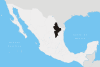
Mier y Noriega is a municipality situated in the far southern region of the Mexican state of Nuevo León.
It borders the municipality of Doctor Arroyo to the north, the only municipality it borders in Nuevo León; the municipality also borders San Luis Potosí and Tamaulipas.[1]
Population
The municipality has 7,095 inhabitants, of which 1,214 live in the town of Mier y Noriega, the seat of the municipality. Other settlements with more than 500 residents include La Cardona, Cerros Blancos, Las Palomas, and Tapona Morena.
History
The municipality was founded in 1849 and is named for Servando Teresa de Mier Noriega y Guerra, a Monterrey native who helped draft the Mexican Constitution of 1824. The first colonial settlement took place at the end of the 19th century by agave farmers, though there had been previous indigenous settlement.[1]
References
- ^ a b (in Spanish) Mier y Noriega
23°25′20″N 100°07′01″W / 23.42222°N 100.11694°W / 23.42222; -100.11694
- v
- t
- e
 State of Nuevo León
Monterrey (capital)
- Abasolo
- Agualeguas
- Allende
- Anáhuac
- Apodaca
- Aramberri
- Bustamante
- Cadereyta Jiménez
- El Carmen
- Cerralvo
- China
- Ciénega de Flores
- Doctor Arroyo
- Doctor Coss
- Doctor González
- Galeana
- García
- General Bravo
- General Escobedo
- General Terán
- General Treviño
- General Zaragoza
- General Zuazua
- Guadalupe
- Hidalgo
- Higueras
- Hualahuises
- Iturbide
- Juárez
- Lampazos de Naranjo
- Linares
- Los Aldamas
- Los Herreras
- Los Ramones
- Marín
- Melchor Ocampo
- Mier y Noriega
- Mina
- Montemorelos
- Monterrey
- Parás
- Pesquería
- Rayones
- Sabinas Hidalgo
- Salinas Victoria
- San Nicolás de los Garza
- San Pedro Garza García
- Santa Catarina
- Santiago
- Vallecillo
- Villaldama
- Monterrey metropolitan area
- Peripheral Region
- Northern Nuevo León
- Salinas Valley
- Citrícola Region
- Pilón Valley
- Southern Nuevo León
- Río Blanco Valley
Authority control databases | |
|---|---|
| International |
|
| National |
|
 | This article about a location in the Mexican state of Nuevo León is a stub. You can help Wikipedia by expanding it. |
- v
- t
- e


