Mount Bogart
Mountain in the country of Canada


Mount Bogart
Location of Mount Bogart in Alberta
Show map of Alberta
Mount Bogart
Mount Bogart (Canada)
Show map of CanadaCanadian Rockies
Mount Bogart is a 3,144-metre (10,315-foot) summit located in Kananaskis Country in the Canadian Rockies of Alberta, Canada.[3] Mount Bogart's nearest higher peak is Wind Mountain, 4.7 km (2.9 mi) to the north.[1] Mount Bogart is situated northwest of Mount Kidd, and both can be seen from Highway 40 near the Kananaskis Village junction.
History
Mount Bogart was named by Donaldson Bogart Dowling (1858-1925), after his mother, whose maiden name was Bogart.[1] Donaldson Dowling, an engineer with the Geological Survey of Canada, explored the area in 1904.
The first ascent of the peak was made in 1930 by Kate Gardiner and Walter Feuz.[4] The duo also made first ascents of Mount Lyautey and Mount Galatea in 1930.[6]
The mountain's name was officially adopted in 2006 by the Geographical Names Board of Canada.[3]
Geology
Mount Bogart is composed of sedimentary rock laid down during the Precambrian to Jurassic periods. Formed in shallow seas, this sedimentary rock was pushed east and over the top of younger rock during the Laramide orogeny.[7]
Climate
Based on the Köppen climate classification, Mount Bogart is located in a subarctic climate with cold, snowy winters, and mild summers.[8] Temperatures can drop below −20 °C with wind chill factors below −30 °C. Precipitation runoff from the mountain drains east into the Kananaskis River and west into Spray Lakes Reservoir which both empty to the Bow River.

References
- ^ a b c d e f "Mount Bogart". Bivouac.com. Retrieved 2018-11-26.
- ^ "Topographic map of Mount Bogart". opentopomap.org. Retrieved 2023-11-22.
- ^ a b c d "Mount Bogart". Geographical Names Data Base. Natural Resources Canada. Retrieved 2018-11-25.
- ^ a b Thorington p. 55
- ^ Kane, Alan (1999). "Mount Bogart". Scrambles in the Canadian Rockies. Calgary: Rocky Mountain Books. p. 146-147. ISBN 0-921102-67-4.
- ^ Thorington p. 19, 56
- ^ Gadd, Ben (2008), Geology of the Rocky Mountains and Columbias
- ^ Peel, M. C.; Finlayson, B. L.; McMahon, T. A. (2007). "Updated world map of the Köppen−Geiger climate classification". Hydrol. Earth Syst. Sci. 11: 1633–1644. ISSN 1027-5606.
- Sources
- Thorington, J. Monroe (1966) [1921]. A Climber's Guide to the Rocky Mountains of Canada. With the collaboration of Putnam, William Lowell (6th ed.). American Alpine Club. ISBN 978-1376169003.
Gallery
-
 Mount Bogart far left, Lougheed center, Skogan Peak right
 -
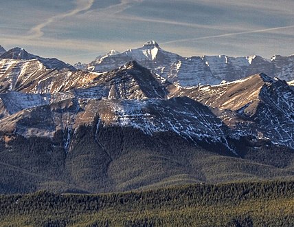 Mount Bogart centered in the distance


External links
 Media related to Mount Bogart at Wikimedia Commons
Places adjacent to Mount Bogart | ||||||||||||||||
|---|---|---|---|---|---|---|---|---|---|---|---|---|---|---|---|---|
| ||||||||||||||||


- v
- t
- e
- Ball
- Bare
- Beaverfoot
- Blue
- Bow
- Crowsnest
- Elk
- Fairholme
- Fiddle
- Flathead
- Foothills
- High Rock
- Kananaskis
- Livingstone
- Lizard
- Maligne
- Massive
- Misty
- Morrissey
- Palliser
- President
- Queen Elizabeth
- Rainbow
- Ram
- Sawback
- Sentinel
- Slate
- South Jasper
- Sundance
- Terminal
- Tower of London
- Vermilion
- Victoria Cross
- Waputik
- Winston Churchill
- Continental Ranges
- Hart Ranges
- Muskwa Ranges
- Alberta
- Andromeda
- Assiniboine
- Athabasca
- Brazeau
- Bryce
- Cascade
- Castle
- Castleguard
- Clemenceau
- Columbia
- Cory
- Edith Cavell
- Forbes
- Hector
- Hosmer
- Hungabee
- Joffre
- Kitchener
- Lyell
- Heart
- Pilot
- Pyramid
- Resplendent
- Robson
- Rundle
- Sarbach
- Saskatchewan
- Smythe
- Snow Dome
- Stanley Peak
- Sulphur
- Temple
- Three Sisters
- Trinity
- Twin
- Ulysses
- Unnamed Alberta–BC mountain (formerly Mount Pétain)
- Whymper
see List of rivers of the Canadian Rockies and Category:Rivers of the Canadian Rockies
- Mountain Stoney
- Mountain Metis
| International | |
|---|---|
| National |
|
| Provincial (AB) |
|
| Provincial (BC) |
- See also
- Geography portal
- Canada portal


