Neumark, Thuringia
Town in Thuringia, Germany

Coat of arms
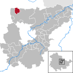
Location of Neumark within Weimarer Land district
(2022–28) Konstantin Pfeiffer[1]
(2022-12-31)[2]
99439
Neumark is a town in the Weimarer Land district, in Thuringia, Germany. It is situated 20 km northeast of Erfurt, and 12 km northwest of Weimar. Neumark is the second-least populous town (Stadt) in Germany (after Arnis), and is the least populous in what was formerly East Germany.
History
Within the German Empire (1871-1918), Neumark was part of the Grand Duchy of Saxe-Weimar-Eisenach.
References
- ^ Gewählte Bürgermeister - aktuelle Landesübersicht, Freistaat Thüringen, accessed 10 November 2022.
- ^ "Bevölkerung der Gemeinden, erfüllenden Gemeinden und Verwaltungsgemeinschaften in Thüringen Gebietsstand: 31.12.2022" (in German). Thüringer Landesamt für Statistik. June 2023.
- v
- t
- e
Towns and municipalities in Weimarer Land
- Am Ettersberg
- Apolda
- Bad Berka
- Bad Sulza
- Ballstedt
- Blankenhain
- Buchfart
- Döbritschen
- Eberstedt
- Ettersburg
- Frankendorf
- Grammetal
- Großheringen
- Großschwabhausen
- Hammerstedt
- Hetschburg
- Hohenfelden
- Ilmtal-Weinstraße
- Kapellendorf
- Kiliansroda
- Kleinschwabhausen
- Klettbach
- Kranichfeld
- Lehnstedt
- Magdala
- Mechelroda
- Mellingen
- Nauendorf
- Neumark
- Niedertrebra
- Obertrebra
- Oettern
- Rittersdorf
- Schmiedehausen
- Tonndorf
- Umpferstedt
- Vollersroda
- Wiegendorf

| Authority control databases: National |
|
|---|
 | This Weimarer Land location article is a stub. You can help Wikipedia by expanding it. |
- v
- t
- e


