Norashen, Gegharkunik
40°30′16″N 45°01′22″E / 40.50444°N 45.02278°E / 40.50444; 45.02278
Place in Gegharkunik, Armenia
Norashen Նորաշեն | |
|---|---|
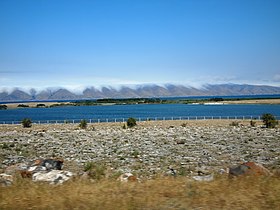
 Scenery around Norashen | |
  Norashen  Norashen | |
| Coordinates: 40°30′16″N 45°01′22″E / 40.50444°N 45.02278°E / 40.50444; 45.02278 | |
| Country | Armenia |
| Province | Gegharkunik |
| Municipality | Sevan |
| Founded | 1920 |
| Population (2011)[1] | |
| • Total | 475 |
| Time zone | UTC+4 (AMT) |
| Norashen, Gegharkunik at GEOnet Names Server | |
Norashen (Armenian: Նորաշեն) is a village in the Sevan Municipality of the Gegharkunik Province of Armenia. The village has a church and a cemetery.
Etymology
The village was previously known as Efendi.
History
The town was founded in 1920 on the site of the former village of Rahmankendi.
Gallery
-
 Scenery around Norashen

References
- ^ Statistical Committee of Armenia. "The results of the 2011 Population Census of Armenia" (PDF).
External links
Wikimedia Commons has media related to Norashen, Gegharkunik.
- Kiesling, Brady (2005), Rediscovering Armenia: Guide, Yerevan, Armenia: Matit Graphic Design Studio
- Kiesling, Brady (June 2000). Rediscovering Armenia: An Archaeological/Touristic Gazetteer and Map Set for the Historical Monuments of Armenia (PDF). Archived (PDF) from the original on 6 November 2021.
- Report of the results of the 2001 Armenian Census, Statistical Committee of Armenia
- v
- t
- e
 Gegharkunik Province
Capital: Gavar

- Akhpradzor
- Akunk
- Areguni
- Arpunk
- Avazan
- Ayrk
- Azat
- Daranak
- Geghakar
- Geghamabak
- Geghamasar
- Jaghatsadzor
- Kakhakn
- Karchaghbyur
- Khachaghbyur
- Kut
- Kutakan
- Lchavan
- Lusakunk
- Makenis
- Mets Masrik
- Nerkin Shorzha
- Norabak
- Norakert
- Pambak
- Pokr Masrik
- Shatjrek
- Shatvan
- Sotk
- Torfavan
- Tretuk
- Tsovak
- Vanevan
- Verin Shorzha
- Zariver
Portal:
 Geography

 | This article about a location in Gegharkunik Province, Armenia is a stub. You can help Wikipedia by expanding it. |
- v
- t
- e


