Petit Bambam Airport
Airstrip in Gabon

Petit Bam-Bam
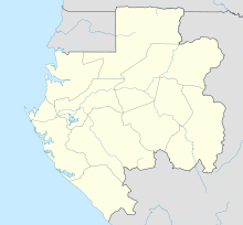
Location of the airport in Gabon
| Direction | Length | Surface | |
|---|---|---|---|
| m | ft | ||
| 08/26 | 1,000 | 3,281 | Grass |
Source: Bing Maps[1] HERE[2]
Petit Bam-Bam Airport (French: Aéroport Petit Bambam) is an airstrip serving Petit Bam-Bam, an exposed geologic formation of white clay overlain with red clay[3] on the border between Estuaire and Moyen-Ogooué Provinces in Gabon.
The airstrip is within Gabon's Wonga Wongue National Park, and is 3 kilometres (2 mi) east of Petit Bam‑bam. It is 13 kilometres (8 mi) southeast of the larger Grand Bam‑bam formation.[4]
The Port Gentil VOR (Ident: PG) is located 52.7 nautical miles (98 km) west-southwest of the airstrip. The Libreville VOR-DME (Ident: LV) is located 58.6 nautical miles (109 km) north of the runway.[5][6]
See also
 Aviation portal
- List of airports in Gabon
- Transport in Gabon

References
- ^ "Petit Bambam Airport". Bing Maps. Microsoft. Retrieved 14 February 2019.
- ^ HERE - Petit Bam-Bam
- ^ "Petit Bambam Cirque". Bing Maps. Microsoft. Retrieved 14 February 2019.
- ^ "--- - Gabon". www.naturatours.com. Archived from the original on 4 March 2016. Retrieved 20 August 2018.
- ^ "Libreville VOR". Our Airports. Retrieved 14 February 2019.
- ^ "Port Gentil VOR". Our Airports. Retrieved 14 February 2019.
External links
- OpenStreetMap - Petit Bambam
- Google Earth
- v
- t
- e
Airports in Gabon
- Akieni
- Bakoumba
- Bitam
- Booué
- Fougamou
- Franceville
- Gamba
- Iguéla
- Koulamoutou
- Lambaréné
- Lastourville
- Libreville
- Makokou
- Mayumba
- Mbigou
- Médouneu
- Mékambo
- Minvoul
- Mitzic
- Moabi
- Moanda
- Mouila
- Mounana
- Ndendé
- Ndjolé
- Okondja
- Omboué
- Oyem
- Petit Bambam
- Port-Gentil
- Sette Cama
- Tchibanga
  | This article about an airport in Gabon is a stub. You can help Wikipedia by expanding it. |
- v
- t
- e


