Planinska Vas, Trbovlje
Place in Styria, Slovenia
46°10′9.25″N 15°1′52.36″E / 46.1692361°N 15.0312111°E / 46.1692361; 15.0312111 Slovenia
 (2002)
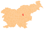
Planinska Vas (pronounced [plaˈniːnska ˈʋaːs]; Slovene: Planinska vas) is a settlement in the Municipality of Trbovlje in central Slovenia. It lies in the hills northwest of the town of Trbovlje. The area is part of the traditional region of Styria. It is now included with the rest of the municipality in the Central Sava Statistical Region.[2]
References
External links
 Media related to Planinska Vas at Wikimedia Commons
- Planinska Vas on Geopedia
- v
- t
- e
Municipality of Trbovlje
Administrative seat: Trbovlje
| Current |
|
|---|---|
| Former |
- Mount Kum
- Trbovlje Chimney
- Trbovlje Museum
- Trbovlje–St. Martin's Parish Church


