Port Glaud
District in Seychelles

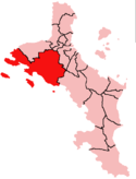
Location within Mahé Island, Seychelles
(2019 Estimate)[1]

Port Glaud (French pronunciation: [pɔʁ ɡlo]) is an administrative district of Seychelles located on the northwestern coast of the island of Mahé. It is 25 km2 and has a population of 2174 (2002 census). The main village is Port Glaud. The district contains two marine parks; Bay Ternay & Port Launay. The offshore islands of Thérèse Island and Conception Island are part of Port Glaud District.
References
- ^ "POPULATION AND VITAL STATISTICS MID YEAR POPULATION ESTIMATES 2019". Statistical Bulletin. Victoria, Mahe, Seychelles: National Bureau of Statistics Seychelles. 2019-08-30. p. 17 (Table 10). Retrieved 2020-01-08.
- ^ "PORT GLAUD". District Profile. Local Government Seychelles. Retrieved 2020-01-12.
- ^ "Port Glaud- Hon. Egbert Aglae". Directly Elected Members by Constituency. The National Assembly of Seychelles. 2016-10-17. Retrieved 2020-01-12.
- v
- t
- e
Districts of Seychelles
Central Mahé
- Bel Air
- Les Mamelles
- Mont Buxton
- English River
- Mont Fleuri
- Plaisance
- Saint Louis
- Roche Caiman

- Anse Boileau
- Port Glaud
- Bel Ombre
- Grand'Anse Mahé
- Outer Islands
4°39′S 55°24′E / 4.650°S 55.400°E / -4.650; 55.400
 | This Seychelles location article is a stub. You can help Wikipedia by expanding it. |
- v
- t
- e


