Puerto Rico Highway 413
Highway in Puerto Rico
Major junctions
 PR-115 in Rincón barrio-pueblo
 PR-4413 in Puntas PR-115 in Río Grande
←  PR-385 PR-385 | →  PR-438 PR-438 |
←  PR-4128 PR-4128 | PR-4413 | →  PR-5139 PR-5139 |
Puerto Rico Highway 413 (PR-413) is a rural road located at the west point of Rincón, Puerto Rico, and is famous in the island for being the main access to beaches near Tres Palmas and the Rincón Lighthouse, where local and international surfing tournaments take place. It is named the Road to Happiness. This highway begins near PR-115 in downtown Rincón, near the west end of Ensenada barrio. Then it passes through Puntas barrio and ends at PR-115, near the south end of Río Grande barrio, heading to Aguada, Puerto Rico.[2][3]
- Puerto Rico Highway 413
-
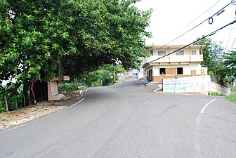
 Heading towards Aguada in Puntas barrio after the entrance to Punta Higuero Light
 -
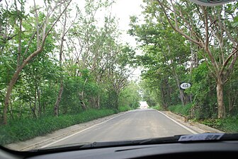
 Heading west in Puntas barrio


Major intersections
The entire route is located in Rincón.
| Location | km[1] | mi | Destinations | Notes | |
|---|---|---|---|---|---|
| Rincón barrio-pueblo | 0.0 | 0.0 | PR-115 (Avenida Profesor Tomás Bonilla Feliciano) – Aguadilla, Mayagüez | Clockwise terminus of PR-413 | |
| Puntas | 2.5 | 1.6 | PR-4413 – Punta Higuero Light | Domes Beach | |
| Río Grande | 6.1 | 3.8 | PR-115 (Avenida Profesor Tomás Bonilla Feliciano) – Rincón, Aguada | Counterclockwise terminus of PR-413 | |
| 1.000 mi = 1.609 km; 1.000 km = 0.621 mi | |||||
Related route
 Highway 4413 | |
|---|---|
| Location | Rincón |
| Length | 1.0 km[4] (0.62 mi) |
Puerto Rico Highway 4413 (PR-4413) is a spur route located in Rincón. It extends from PR-413 to Domes Beach near Punta Higuero Light.[5] The entire route is located in Puntas, Rincón.
| km[4] | mi | Destinations | Notes | ||
|---|---|---|---|---|---|
| 0.0 | 0.0 |  PR-413 – Rincón PR-413 – Rincón | Southern terminus of PR-4413 | ||
| 1.0 | 0.62 | Northern terminus of PR-4413 at Domes Beach; dead end road | |||
| 1.000 mi = 1.609 km; 1.000 km = 0.621 mi | |||||
See also
 Puerto Rico portal
 U.S. Roads portal

References
- ^ a b "PR-413" (Map). Google Maps. Retrieved 28 February 2020.
- ^ National Geographic Maps (2011). Puerto Rico (Map). 1:125,000. Adventure Map (Book 3107). Evergreen, Colorado: National Geographic Maps. ISBN 978-1566955188. OCLC 756511572.
- ^ "Tránsito Promedio Diario (AADT)". Transit Data (Datos de Transito) (in Spanish). DTOP PR. p. 109. Archived from the original on 1 April 2019.
- ^ a b "PR-4413" (Map). Google Maps. Retrieved 22 March 2020.
- ^ "PR-4413, Aguada, Rincón 00602, Puerto Rico". Mapio.net. Retrieved 22 March 2020.
External links
 Media related to Puerto Rico Highway 413 at Wikimedia Commons
- v
- t
- e
 | This Puerto Rico road-related article is a stub. You can help Wikipedia by expanding it. |
- v
- t
- e


