Puerto Rico Highway 510
Highway in Puerto Rico
Major junctions
 PR-1 in Capitanejo
 PR-5510 in Sabana Llana
 PR-5509 in Sabana Llana
 PR-149 in Amuelas
 PR-584 in Amuelas
 PR-14 in Tijeras
←  PR-506 PR-506 | →  PR-511 PR-511 |
←  PR-5506 PR-5506 | PR-5510 | →  PR-5525 PR-5525 |
Puerto Rico Highway 510 (PR-510) is a tertiary[3] highway in southern Puerto Rico. The road runs north to south in a general south-southwestern direction. The road connects PR-1 in Barrio Capitanejo, Ponce, to PR-14 in the town of Juana Díaz. Portions of the Juana Díaz portion of the road were damaged in September 2017 by Hurricane Maria.[4]
-
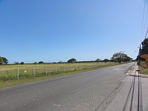 A stretch of PR-510 in Barrio Capitanejo, looking south

Major intersections
| Municipality | Location | km[1][2] | mi | Destinations | Notes |
|---|---|---|---|---|---|
| Ponce | Capitanejo | 0.0 | 0.0 | PR-1 – Ponce, Santa Isabel | Southern terminus of PR-510 |
| Juana Díaz | Sabana Llana | 1.1– 1.2 | 0.68– 0.75 |  PR-5510 – Capitanejo PR-5510 – Capitanejo | |
| 2.3– 2.4 | 1.4– 1.5 |  PR-5509 – Sabana Llana PR-5509 – Sabana Llana | |||
| Amuelas | 5.3 68.3[a] | 3.3 42.4 |  PR-149 – Juana Díaz, Villalba PR-149 – Juana Díaz, Villalba | Northern terminus of PR-149 concurrency | |
| 68.5[a] 5.4 | 42.6 3.4 | PR-149 – Cintrona | Southern terminus of PR-149 concurrency | ||
| 9.5 | 5.9 |  PR-584 (Avenida Víctor Cruz) – Juana Díaz, Ponce PR-584 (Avenida Víctor Cruz) – Juana Díaz, Ponce | |||
| Tijeras | 10.3 | 6.4 | PR-14 (Carretera Central) – Juana Díaz, Coamo | Northern terminus of PR-510 | |
1.000 mi = 1.609 km; 1.000 km = 0.621 mi
| |||||
- ^ a b Kilometer markers represent the distance along PR-149 rather than PR-510.
Related route
Highway 5510 | |
|---|---|
| Location | Ponce – Juana Díaz |
| Length | 1.4 km[5] (0.87 mi) |

Puerto Rico Highway 5510 (PR-5510) is a spur route located in between Ponce and Juana Díaz. It begins at PR-1 in Barrio Capitanejo and ends at its junction with PR-510 in Barrio Sabana Llana.[6]
-
 Puerto Rico Highway 5510 north in Barrio Capitanejo
 -
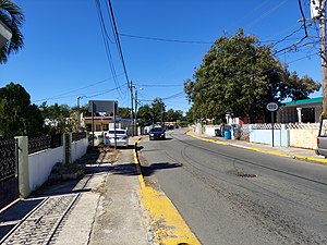 A stretch of PR-5510 in Barrio Capitanejo, looking south


| Municipality | Location | km[5] | mi | Destinations | Notes |
|---|---|---|---|---|---|
| Ponce | Capitanejo | 0.0 | 0.0 | PR-1 – Ponce, Santa Isabel | Southern terminus of PR-5510 |
| Juana Díaz | Sabana Llana | 1.4 | 0.87 |  PR-510 – Juana Díaz PR-510 – Juana Díaz | Northern terminus of PR-5510 |
| 1.000 mi = 1.609 km; 1.000 km = 0.621 mi | |||||
See also
 Puerto Rico portal
 U.S. Roads portal

References
- ^ a b Google (1 March 2020). "PR-510 west" (Map). Google Maps. Google. Retrieved 1 March 2020.
- ^ a b Google (1 March 2020). "PR-510 east" (Map). Google Maps. Google. Retrieved 1 March 2020.
- ^ PRHTA Design Manual: Chapter 1, General Design Criteria. Departamento de Transportación y Obras Publicas de Puerto Rico. page 1-2. Accessed 9 May 2019.
- ^ Abundan los problemas de infraestructura y burocracia a un año de María: A juicio del alcalde de Juana Díaz, Ramón Hernández Torres, el persistente desasosiego en los habitantes de la zona tiene su génesis en la desorganización que aún aqueja al gobierno central. Jason Rodríguez Grafal. La Perla del Sur. Ponce, Puerto Rico. Year 35. Issue 1815. Pages 4-5. 12 September 2018. Accessed 12 September 2018.
- ^ a b Google (22 March 2020). "PR-5510" (Map). Google Maps. Google. Retrieved 22 March 2020.
- ^ "PR-5510, Juana Díaz, Puerto Rico". geoview.info. Retrieved 22 March 2020.
External links
Wikimedia Commons has media related to Puerto Rico Highway 510 and Puerto Rico Highway 5510.
- Guía de Carreteras Principales, Expresos y Autopistas (in Spanish)
- v
- t
- e


