São Francisco Bay
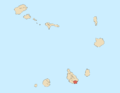
The São Francisco Bay (Portuguese: Baía de São Francisco, also Porto de São Francisco) is a bay on the southeastern coast of the island of Santiago, Cape Verde. It is situated 8 km northeast of the city centre of Praia, the capital of Cape Verde. The bay was mentioned in the 1747 map by Jacques-Nicolas Bellin as "St. Francisco".[1]
References
- ^ Jacques-Nicolas Bellin (1747). "Carte des Isles du Cap Verd = Kaart van de Eilanden van Kabo Verde" (in French).
- v
- t
- e
City of Praia
- Achada Grande Frente
- Achada Grande Tras
- Achada Santo António
- Achadinha
- Bairro Craveiro Lopes
- Calabaceira
- Chã de Areia
- Fazenda
- Lem Ferreira
- Palmarejo
- Plateau
- Ponta de Água
- Prainha
- Quebra Canela
- São Francisco
- Terra Branca
- Tira Chapéu
- Várzea
- Vila Nova

- Cape Verdean National Archives (ANCV)
- Museu Etnográfico da Praia
- National Auditorium
- National Library of Cape Verde
- Quintal da Música
- Tabanka
- Capture of Santiago (1585)
- Battle of Porto Praya (1780)
- Cape Verde
- Barlavento
- Santiago
- Praia
The island of Santiago | ||
|---|---|---|
| Mountains |  | |
| Streams |
| |
| Points and promontories | ||
| Other geographic features | ||
| Transportation | ||
| Other topics | ||
| ||

14°58′N 23°28′W / 14.97°N 23.46°W / 14.97; -23.46


