Samotorica
Place in Inner Carniola, Slovenia
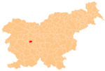
46°1′47.12″N 14°14′58.12″E / 46.0297556°N 14.2494778°E / 46.0297556; 14.2494778 Slovenia
 (2002)
Samotorica (pronounced [samɔˈtoːɾitsa]) is a dispersed settlement in the hills northwest of Horjul in the Inner Carniola region of Slovenia.
Name
Samotorica was first mentioned in written records in 1340 as Zamatůrnicz (and in 1489 as Samotoritz and Samatoritz). The name may be derived from the Slavic common noun *samotvorъ 'natural feature', referring to some striking landscape element, or perhaps from the hypothetical personal name *Samotvor.[2]
Church

The local church in the settlement is dedicated to Archangel Michael and belongs to the Parish of Horjul. It contains early 16th-century frescos and a painted wooden ceiling.[3]
References
External links
 Media related to Samotorica at Wikimedia Commons
- Samotorica on Geopedia
- v
- t
- e
Municipality of Horjul
- Kristina Brenk
- Neža Cankar
- Tine Logar
- Franc Veriti


