Sankt Stefan am Walde
Place in Upper Austria, Austria
Coat of arms
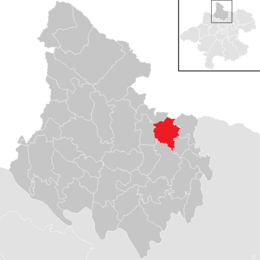
Location in the district
[1]
(2018-01-01)[2]
4170
Sankt Stefan am Walde was a municipality in the district of Rohrbach in the Austrian state of Upper Austria.
Population
| Year | Pop. | ±% |
|---|---|---|
| 1869 | 1,035 | — |
| 1880 | 963 | −7.0% |
| 1890 | 933 | −3.1% |
| 1900 | 867 | −7.1% |
| 1910 | 825 | −4.8% |
| 1923 | 783 | −5.1% |
| 1934 | 840 | +7.3% |
| 1939 | 857 | +2.0% |
| 1951 | 820 | −4.3% |
| 1961 | 722 | −12.0% |
| 1971 | 797 | +10.4% |
| 1981 | 853 | +7.0% |
| 1991 | 853 | +0.0% |
| 2001 | 843 | −1.2% |
| 2011 | 819 | −2.8% |
| 2017 | 804 | −1.8% |
References
Wikimedia Commons has media related to Sankt Stefan am Walde.
Authority control databases | |
|---|---|
| International |
|
| National |
|
- v
- t
- e


