Sasbachwalden
You can help expand this article with text translated from the corresponding article in German. (February 2009) Click [show] for important translation instructions.
- View a machine-translated version of the German article.
- Machine translation, like DeepL or Google Translate, is a useful starting point for translations, but translators must revise errors as necessary and confirm that the translation is accurate, rather than simply copy-pasting machine-translated text into the English Wikipedia.
- Do not translate text that appears unreliable or low-quality. If possible, verify the text with references provided in the foreign-language article.
- You must provide copyright attribution in the edit summary accompanying your translation by providing an interlanguage link to the source of your translation. A model attribution edit summary is
Content in this edit is translated from the existing German Wikipedia article at [[:de:Sasbachwalden]]; see its history for attribution. - You may also add the template
{{Translated|de|Sasbachwalden}}to the talk page. - For more guidance, see Wikipedia:Translation.
Municipality in Baden-Württemberg, Germany

Coat of arms
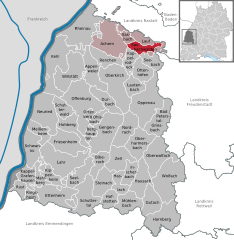
Location of Sasbachwalden within Ortenaukreis district
(2022-12-31)[2]
77887
Sasbachwalden is a Black Forest municipality in Western Baden-Württemberg, Germany, popular with tourists. It is located on the western slopes of mountain Hornisgrinde in the Northern Black Forest and belongs to the district of Ortenau. More than 70% of the town area are forest.
History
Sasbachwalden was first mentioned in 1347 as a group of individual farms and houses. Only in 1817 Sasbachwalden became an independent community. Since 1973 the town belongs to district of Ortenau.
Education
The town has a centrally located kindergarten and elementary school. Institutions for higher education are in the nearby towns Achern and Sasbach.
Economy
Main sources of income are tourism, winegrowing, the production of Black Forest kirsch and most importantly wood processing.
See also
References
- ^ Bürgermeisterwahl Sasbachwalden 2024, Staatsanzeiger. Retrieved 12 June 2024.
- ^ "Bevölkerung nach Nationalität und Geschlecht am 31. Dezember 2022" [Population by nationality and sex as of December 31, 2022] (CSV) (in German). Statistisches Landesamt Baden-Württemberg. June 2023.
- v
- t
- e
Towns and municipalities in Ortenau (district)
- Achern
- Appenweier
- Bad Peterstal-Griesbach
- Berghaupten
- Biberach
- Durbach
- Ettenheim
- Fischerbach
- Friesenheim
- Gengenbach
- Gutach
- Haslach
- Hausach
- Hofstetten
- Hohberg
- Hornberg
- Kappel-Grafenhausen
- Kappelrodeck
- Kehl
- Kippenheim
- Lahr/Schwarzwald
- Lauf
- Lautenbach
- Mahlberg
- Meißenheim
- Mühlenbach
- Neuried
- Nordrach
- Oberharmersbach
- Oberkirch
- Oberwolfach
- Offenburg
- Ohlsbach
- Oppenau
- Ortenberg
- Ottenhöfen im Schwarzwald
- Renchen
- Rheinau
- Ringsheim
- Rust
- Sasbach
- Sasbachwalden
- Schuttertal
- Schutterwald
- Schwanau
- Seebach
- Seelbach
- Steinach
- Willstätt
- Wolfach
- Zell am Harmersbach

Authority control databases | |
|---|---|
| International |
|
| National |
|
 | This Ortenaukreis location article is a stub. You can help Wikipedia by expanding it. |
- v
- t
- e


