Shire of Donnybrook–Balingup
Local government area in the South West region of Western Australia
| Shire of Donnybrook Balingup Western Australia | |||||||||||||||
|---|---|---|---|---|---|---|---|---|---|---|---|---|---|---|---|
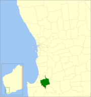 Location in Western Australia | |||||||||||||||
 | |||||||||||||||
| Population | 6,155 (LGA 2021)[1] | ||||||||||||||
| Established | 1970 | ||||||||||||||
| Area | 1,560.3 km2 (602.4 sq mi) | ||||||||||||||
| Shire President | Vivienne MacCarthy | ||||||||||||||
| Council seat | Donnybrook | ||||||||||||||
| Region | South West | ||||||||||||||
| State electorate(s) | Collie-PrestonWarren-Blackwood | ||||||||||||||
| Federal division(s) | Forrest | ||||||||||||||
| Website | Shire of Donnybrook Balingup | ||||||||||||||
| |||||||||||||||
The Shire of Donnybrook Balingup is a local government area in the South West region of Western Australia, about 35 kilometres (22 mi) southeast of Bunbury and about 220 kilometres (137 mi) south of the state capital, Perth. The Shire covers an area of about 1,560 square kilometres (602 sq mi), and its seat of government is the town of Donnybrook.
History
The Shire of Donnybrook–Balingup was established on 26 March 1970 with the amalgamation of the Shire of Donnybrook and the Shire of Balingup. The merged shire initially retained the Donnybrook name, but adopted the Donnybrook-Balingup name on 17 July 1970.[2] The new council was administered from Donnybrook.
The Shire of Donnybrook–Balingup is also home to a number of heritage-listed historic properties including Ferndale Homestead and Southampton homestead.
Indigenous people
The Shire of Donnybrook–Balingup is located on the traditional land of the Wardandi people of the Noongar nation.[3][4][5]
Wards
In 2001 the Shire abolished wards and all nine councillors represent the entire shire.
Prior to this, four wards made up the council:
- Donnybrook (including Argyle, Irishtown and Beelerup)
- Preston (area east of Donnybrook including Lowden, Mumballup and Noggerup)
- Central (including Kirup, Upper Capel, Brazier, Newlands, Brookhampton and Thompsons Brook)
- Balingup (including Mullalyup, Grimwade, Upper Balingup, Southampton and Ferndale[Lower Balingup])
Towns and localities
The towns and localities of the Shire of Donnybrook-Balingup with population and size figures based on the most recent Australian census:[6][7]
| Locality | Population | Area | Map |
|---|---|---|---|
| Argyle | 575 (SAL 2021)[8] | 13.8 km2 (5.3 sq mi) |  |
| Balingup | 565 (SAL 2021)[9] | 88.5 km2 (34.2 sq mi) |  |
| Beelerup | 126 (SAL 2021)[10] | 27 km2 (10 sq mi) |  |
| Brazier | 40 (SAL 2021)[11] | 79 km2 (31 sq mi) |  |
| Brookhampton | 249 (SAL 2021)[12] | 54.3 km2 (21.0 sq mi) |  |
| Charley Creek | 68 (SAL 2021)[13] | 21.7 km2 (8.4 sq mi) |  |
| Cundinup * | 62 (SAL 2021)[14] | 156.5 km2 (60.4 sq mi) |  |
| Donnybrook | 3,035 (SAL 2021)[15] | 25 km2 (9.7 sq mi) |  |
| Glen Mervyn | 47 (SAL 2021)[16] | 37.8 km2 (14.6 sq mi) |  |
| Grimwade | 0 (SAL 2016)[17][18] | 50 km2 (19 sq mi) |  |
| Kirup | 156 (SAL 2021)[19] | 76.9 km2 (29.7 sq mi) |  |
| Lowden | 165 (SAL 2021)[20] | 44.7 km2 (17.3 sq mi) |  |
| Mullalyup | 149 (SAL 2021)[21] | 82.7 km2 (31.9 sq mi) |  |
| Mumballup | 100 (SAL 2021)[22] | 40.6 km2 (15.7 sq mi) |  |
| Newlands | 112 (SAL 2021)[23] | 23.4 km2 (9.0 sq mi) |  |
| Noggerup | 99 (SAL 2021)[24] | 194.9 km2 (75.3 sq mi) |  |
| Paynedale | 60 (SAL 2021)[25] | 76.5 km2 (29.5 sq mi) |  |
| Queenwood | 79 (SAL 2021)[26] | 34.3 km2 (13.2 sq mi) |  |
| Southampton | 84 (SAL 2021)[27] | 126.1 km2 (48.7 sq mi) |  |
| Thomson Brook | 89 (SAL 2021)[28] | 86.5 km2 (33.4 sq mi) |  |
| Upper Capel | 177 (SAL 2021)[29] | 107.9 km2 (41.7 sq mi) |  |
| Wilga West | 18 (SAL 2021)[30] | 178 km2 (69 sq mi) |  |
| Yabberup | 162 (SAL 2021)[31] | 68.6 km2 (26.5 sq mi) |  |
- (* indicates locality is only partially located within this shire)
Heritage-listed places
As of 2023, 113 places are heritage-listed in the Shire of Donnybrook–Balingup,[32] of which twelve are on the State Register of Heritage Places, among them the Southampton homestead.[33]
References
- ^ Australian Bureau of Statistics (28 June 2022). "Donnybrook-Balingup (Local Government Area)". Australian Census 2021 QuickStats. Retrieved 28 June 2022.

- ^ "Municipality Boundary Amendments Register" (PDF). Western Australian Electoral Distribution Commission. Retrieved 11 January 2020.
- ^ "Map of Indigenous Australia". aiatsis.gov.au. Australian Institute of Aboriginal and Torres Strait Islander Studies. Retrieved 14 July 2024.
- ^ "Catalog of Australian Aboriginal Tribes". www.samuseum.sa.gov.au. South Australian Museum. Retrieved 14 July 2024.
- ^ "Welcome to the Shire of Donnybrook Balingup". www.donnybrook-balingup.wa.gov.au. Shire of Donnybrook–Balingup. Retrieved 14 July 2024.
The Shire of Donnybrook Balingup acknowledges the traditional custodians of the land, the Wardandi People of the Noongar Nation
- ^ "SLIP Map". maps.slip.wa.gov.au. Landgate. Retrieved 4 February 2023.
- ^ "NationalMap". nationalmap.gov.au. Geoscience Australia. Retrieved 4 February 2023.
- ^ Australian Bureau of Statistics (28 June 2022). "Argyle (WA) (suburb and locality)". Australian Census 2021 QuickStats. Retrieved 28 June 2022.
- ^ Australian Bureau of Statistics (28 June 2022). "Balingup (suburb and locality)". Australian Census 2021 QuickStats. Retrieved 28 June 2022.
- ^ Australian Bureau of Statistics (28 June 2022). "Beelerup (suburb and locality)". Australian Census 2021 QuickStats. Retrieved 28 June 2022.
- ^ Australian Bureau of Statistics (28 June 2022). "Brazier (suburb and locality)". Australian Census 2021 QuickStats. Retrieved 28 June 2022.
- ^ Australian Bureau of Statistics (28 June 2022). "Brookhampton (suburb and locality)". Australian Census 2021 QuickStats. Retrieved 28 June 2022.
- ^ Australian Bureau of Statistics (28 June 2022). "Charley Creek (suburb and locality)". Australian Census 2021 QuickStats. Retrieved 28 June 2022.
- ^ Australian Bureau of Statistics (28 June 2022). "Cundinup (suburb and locality)". Australian Census 2021 QuickStats. Retrieved 28 June 2022.
- ^ Australian Bureau of Statistics (28 June 2022). "Donnybrook (WA) (suburb and locality)". Australian Census 2021 QuickStats. Retrieved 28 June 2022.
- ^ Australian Bureau of Statistics (28 June 2022). "Glen Mervyn (suburb and locality)". Australian Census 2021 QuickStats. Retrieved 28 June 2022.
- ^ Australian Bureau of Statistics (27 June 2017). "Grimwade (suburb and locality)". Australian Census 2016.
- ^ Australian Bureau of Statistics (27 June 2017). "Grimwade (suburb and locality)". Australian Census 2016 QuickStats. Retrieved 28 June 2022.
- ^ Australian Bureau of Statistics (28 June 2022). "Kirup (suburb and locality)". Australian Census 2021 QuickStats. Retrieved 28 June 2022.
- ^ Australian Bureau of Statistics (28 June 2022). "Lowden (suburb and locality)". Australian Census 2021 QuickStats. Retrieved 28 June 2022.
- ^ Australian Bureau of Statistics (28 June 2022). "Mullalyup (suburb and locality)". Australian Census 2021 QuickStats. Retrieved 28 June 2022.
- ^ Australian Bureau of Statistics (28 June 2022). "Mumballup (suburb and locality)". Australian Census 2021 QuickStats. Retrieved 28 June 2022.
- ^ Australian Bureau of Statistics (28 June 2022). "Newlands (WA) (suburb and locality)". Australian Census 2021 QuickStats. Retrieved 28 June 2022.
- ^ Australian Bureau of Statistics (28 June 2022). "Noggerup (suburb and locality)". Australian Census 2021 QuickStats. Retrieved 28 June 2022.
- ^ Australian Bureau of Statistics (28 June 2022). "Paynedale (suburb and locality)". Australian Census 2021 QuickStats. Retrieved 28 June 2022.
- ^ Australian Bureau of Statistics (28 June 2022). "Queenwood (suburb and locality)". Australian Census 2021 QuickStats. Retrieved 28 June 2022.
- ^ Australian Bureau of Statistics (28 June 2022). "Southampton (WA) (suburb and locality)". Australian Census 2021 QuickStats. Retrieved 28 June 2022.
- ^ Australian Bureau of Statistics (28 June 2022). "Thomson Brook (suburb and locality)". Australian Census 2021 QuickStats. Retrieved 28 June 2022.
- ^ Australian Bureau of Statistics (28 June 2022). "Upper Capel (suburb and locality)". Australian Census 2021 QuickStats. Retrieved 28 June 2022.
- ^ Australian Bureau of Statistics (28 June 2022). "Wilga West (suburb and locality)". Australian Census 2021 QuickStats. Retrieved 28 June 2022.
- ^ Australian Bureau of Statistics (28 June 2022). "Yabberup (suburb and locality)". Australian Census 2021 QuickStats. Retrieved 28 June 2022.
- ^ "Shire of Donnybrook-Balingup Heritage Places". inherit.stateheritage.wa.gov.au. Heritage Council of Western Australia. Retrieved 25 February 2023.
- ^ "Shire of Donnybrook-Balingup State Register of Heritage Places". inherit.stateheritage.wa.gov.au. Heritage Council of Western Australia. Retrieved 25 February 2023.
External links
- Official website
- v
- t
- e
| Cities | |
|---|---|
| Towns | |
| Shires |
- Augusta–Margaret River
- Boyup Brook
- Bridgetown–Greenbushes
- Bunbury*
- Busselton*
- Capel
- Collie
- Dardanup
- Donnybrook–Balingup
- Harvey
- Manjimup
- Nannup
- Beverley
- Brookton
- Bruce Rock
- Chittering
- Corrigin
- Cuballing
- Cunderdin
- Dalwallinu
- Dandaragan
- Dowerin
- Dumbleyung
- Gingin
- Goomalling
- Kellerberrin
- Kondinin
- Koorda
- Kulin
- Lake Grace
- Merredin
- Moora
- Mount Marshall
- Mukinbudin
- Narembeen
- Narrogin
- Northam
- Nungarin
- Pingelly
- Quairading
- Tammin
- Toodyay
- Trayning
- Victoria Plains
- Wagin
- Wandering
- West Arthur
- Westonia
- Wickepin
- Williams
- Wongan–Ballidu
- Wyalkatchem
- Yilgarn
- York
- Christmas Island#
- Cocos (Keeling) Islands#
| Authority control databases |
|
|---|
33°34′37″S 115°49′16″E / 33.577°S 115.821°E / -33.577; 115.821


