St Boniface Down

St Boniface Down
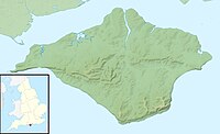
Location of St Boniface Down in the Isle of Wight
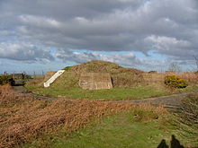

St Boniface Down is a chalk down near Ventnor, on the Isle of Wight, England. Its summit, 241 metres (791 ft), is the highest point on the island,[1] with views on a clear day stretching over 70 miles from Beachy Head to the east, Walbury Hill to the north, the Isle of Portland to the west and the French coast of Normandy to the south. It is 1 kilometre (0.6 mi) north of the town.[2] There is reputed to be a wishing well on its southern slope, which requires the wisher to climb up from the south without looking back. In 1545, a French invasion force attempted this against a force of the Isle of Wight Militia commanded by Sir John Fyssher – which allegedly included several women archers- and were routed. In 1940, the radar station was bombed by Ju 87 Stuka dive bombers, which is reconstructed in the film "The Battle of Britain". The top is surmounted by a round barrow.
At the eastern foot of the down, on the A3055 road between Bonchurch and Luccombe, a path descends into Bonchurch Landslips via a scenic rock cleft, the Devil's Chimney.
Wildlife
St Boniface Down is home to the largest cricket species within the British Isles, the great green bush cricket.
The area includes some unusual plant communities including acid grassland and heathland, resulting in parts of the Down being designated as a Site of Special Scientific Interest. The gravel capping supports extensive tracts of gorse Ulex europaeus with intervening areas of heathland and acid grassland dominated by heather Calluna vulgaris, bell heather Erica cinerea, purple moor-grass Molinia caerulea, bristle bent Agrostis curtisii and locally bilberry Vaccinium myrtillus. The occurrence of heathland on deep gravel overlying chalk, the naturalised holm oak woodland and the juxtaposition of heath and chalkland vegetation are all unusual biological features in Britain.[3]
Cultural references
St Boniface Down is also the name and was the inspiration of a 1956 work by the English composer, Trevor Duncan.
References
- v
- t
- e
- Alverstone Marshes
- America Wood
- Arreton Down
- Bembridge Down
- Bembridge School And Cliffs
- Bonchurch Landslips
- Bouldnor And Hamstead Cliffs
- Brading Marshes To St. Helen's Ledges
- Briddlesford Copses
- Calbourne Down
- Colwell Bay
- Compton Chine to Steephill Cove
- Compton Down
- Cranmore
- Cridmore Bog
- Eaglehead and Bloodstone Copses
- Freshwater Marshes
- Garstons Down
- Greatwood And Cliff Copses
- Headon Warren And West High Down
- King's Quay Shore
- Lacey's Farm Quarry
- Lake Allotments
- Locks Farm Meadow
- Medina Estuary
- Mottistone Down
- Newtown Harbour
- Northpark Copse
- Parkhurst Forest
- Priory Woods
- Prospect Quarry
- Rew Down
- Rowridge Valley
- Ryde Sands and Wootton Creek
- Shide Quarry
- St Lawrence Bank
- The Wilderness
- Thorness Bay
- Ventnor Downs
- Whitecliff Bay And Bembridge Ledges
- Yar Estuary
50°36′12″N 1°11′55″W / 50.60346°N 1.19873°W / 50.60346; -1.19873
 | This Isle of Wight location article is a stub. You can help Wikipedia by expanding it. |
- v
- t
- e


