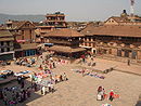
Suryabinayak Municipality
Place in Bagmati, Nepal

Suryabinak Municipality
Seal
27°40′N 85°24′E / 27.667°N 85.400°E / 27.667; 85.400
(2021 Nepal census)
Suryabinayak Municipality (Nepali: सुर्यविनायक नगरपालिका) is a municipality in Bagmati Province in Central Nepal. It is the largest municipality of Bhaktapur district with a population of 137,971 with 23,637 households.[1] It was created in December 2014 through the merger of the Village development committees of Kautunje (the municipality's centre[2]), Sipadol, Nankhel and Chitpol.[3] The municipality's name stems from the local Suryavinayak Temple.[2] In March 2017, under new local level restructuring,[4] Suryabinayak Municipality was expanded to include the neighboring municipality of Anantalingeshwor, adding four more previous VDCs of Sirutar, Gundu, Dadhikot and Balkot. According to the 2021 Nepal census, the predecessors of Suryabinayak Municipality had a population of 140,085.[5]
Transportation
Different Buses from Dhulikhel and Panauti depart and arrive every of 5 min to Kathmandu. As well other different transport is available from Suryabinayak.
Demographics
Population Change
Graphs are unavailable due to technical issues. There is more info on Phabricator and on MediaWiki.org. |
Sex ratio
Distribution of population on the basis of age group
Population According to Age Group:[8]
0-14 (21.2%)
14-64 (73.1%)
64+ (5.6%)
References
- ^ "Suryabinayak Municipality | Office of the Municipal Executive". www.suryabinayakmun.gov.np. Archived from the original on 22 May 2024. Retrieved August 6, 2024.
- ^ a b "सुर्यविनायक नगरपालिका परिचय" (in Nepali). सुर्यविनायक नगरपालिका. Retrieved 1 May 2018.
- ^ "Govt announces 61 municipalities". The Kathmandu Post. 2 December 2014. Retrieved 1 May 2018.
- ^ "New local level units come into existence". The Kathmandu Post. Retrieved 27 September 2017.
- ^ "Nepal Census 2021". Central Bureau of Statistics (Nepal) . Archived from the original on 2024-04-03. Retrieved 2024-08-06.
- ^ "Change of population in Suryabinak". www.cityfacts.com.
- ^ "Sex Ratio of Suryabinak municipality". www.cityfacts.com.
- ^ "Population distribution on the basis of age group". www.cityfacts.com.
External links
- Suryabinayak Municipality Official Page
- v
- t
- e
Headquarter: Bhaktapur
- Bhaktapur Municipality
- Changunarayan Municipality
- Madhyapur Thimi Municipality
- Suryabinayak Municipality


