Tabaruzaka Station
Railway station in Kumamoto, Japan
32°53′59″N 130°39′12″E / 32.8996°N 130.6532°E / 32.8996; 130.6532
| Preceding station | Following station | |||
|---|---|---|---|---|
| Ueki towards Kagoshima | Kagoshima Main Line | Konoha towards Mojikō | ||
Location | |
|---|---|
  Tabaruzaka Station Location within Kumamoto Prefecture Show map of Kumamoto Prefecture Tabaruzaka Station Tabaruzaka Station (Japan) Show map of Japan | |
 |
Tabaruzaka Station (田原坂駅, Tabaruzaka-eki) is a passenger railway station located in the Kita-ku ward of the city of Kumamoto, Kumamoto Prefecture, Japan. It is operated by JR Kyushu.[1][2]
Lines
The station is served by the Kagoshima Main Line and is located 180.2 km from the starting point of the line at Mojiko.[3]
Layout
The station consists of two side platforms serving two tracks on a side hill cutting. A steep sloping ramp leads up to the station from the access road. The station building is a simple, functional, brick structure which is unstaffed and serves only as a waiting room. Access to the opposite side platform is by means of a footbridge.[2][3]
Platforms
| 1 | ■ ■ Kagoshima Main Line | for Tamana, Ōmuta and Tosu |
| 2 | ■ ■ Kagoshima Main Line | for Kumamoto and Yatsushiro |
-
 A view of the platforms and tracks.
 -
 View from the station looking down onto the access road.
 -
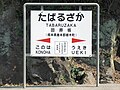 Signage


History
Japanese Government Railways (JGR) opened Tabaruzaka signal box on 1 October 1943 on the existing track of the Kagoshima Main Line. On 1 October 1965, Japanese National Railways (JNR) upgraded the facility to full station. With the privatization of JNR on 1 April 1987, JR Kyushu took over control of the station.[4]
Passenger statistics
In fiscal 2014, the station was used by an average of 24 passengers daily (boarding passengers only).[5]
Surrounding area
The area around the station is surrounded by hills and covered with fields and orchards, but there are settlements scattered on the hills to the east, leading to the Ueki city area. About 800 m to the east, there is the Sanko Bus Shichimoto stop, which connects the Kumamoto Sakuramachi Bus Terminal to Uekimachi.
See also
References
- ^ "JR Kyushu Route Map" (PDF). JR Kyushu. Retrieved 23 February 2018.
- ^ a b "田原坂" [Tabaruzaka]. hacchi-no-he.net. Retrieved 26 April 2018.
- ^ a b Kawashima, Ryōzō (2013). 図説: 日本の鉄道 四国・九州ライン 全線・全駅・全配線・第6巻 熊本 大分 エリア [Japan Railways Illustrated. Shikoku and Kyushu. All lines, all stations, all track layouts. Volume 6 Kumamoto Ōita Area] (in Japanese). Kodansha. pp. 20, 68. ISBN 9784062951654.
- ^ Ishino, Tetsu; et al., eds. (1998). 停車場変遷大事典 国鉄・JR編 [Station Transition Directory – JNR/JR] (in Japanese). Vol. II. Tokyo: JTB Corporation. p. 683. ISBN 4-533-02980-9.
- ^ "熊本地域公共交通網形成計画" [Kumamoto area public transport network plan]. Kumamoto City official website. 11 April 2016. Retrieved 3 April 2018. See Chapter 4: 公共交通の現状等 (Present situation of public transport)
External links
![]() Media related to Tabaruzaka Station at Wikimedia Commons
Media related to Tabaruzaka Station at Wikimedia Commons
- Tabaruzaka (JR Kyushu)(in Japanese)
- v
- t
- e
Stations of the JR Kyushu Kagoshima Main Line
- Mojikō
- Komorie
- Moji
- Kitakyushu Freight Terminal
- Higashi-Kokura Freight Terminal
- Kokura
- Nishi-Kokura
- Hama-Kokura Freight Terminal
- Kyūshūkōdaimae
- Tobata
- Edamitsu
- Space World
- Yahata
- Kurosaki
- Jinnoharu
- Orio
- Mizumaki
- Ongagawa
- Ebitsu
- Kyōikudaimae
- Akama
- Tōgō
- Higashi-Fukuma
- Fukuma
- Chidori
- Koga
- Shishibu
- Shingū-Chūō
- Fukkōdaimae
- Kyusandaimae
- Kashii
- Chihaya
- Chihaya Yard
- Hakozaki
- Yoshizuka
- Hakata
- Takeshita
- Sasabaru
- Minami-Fukuoka
- Kasuga
- Ōnojō
- Mizuki
- Tofurōminami
- Futsukaichi
- Tenpaizan
- Haruda
- Keyakidai
- Kiyama
- Yayoigaoka
- Tashiro
- Tosu
- Hizen-Asahi
- Kurume
- Araki
- Nishimuta
- Hainuzuka
- Chikugo-Funagoya
- Setaka
- Minami-Setaka
- Wataze
- Yoshino
- Ginsui
- Ōmuta
- Arao
- Minami-Arao
- Nagasu
- Ōnoshimo
- Tamana
- Higo-Ikura
- Konoha
- Tabaruzaka
- Ueki
- Nishisato
- Sōjōdaigakumae
- Kami-Kumamoto
- Kumamoto
- Nishi-Kumamoto
- Kawashiri
- Tomiai
- Uto
- Matsubase
- Ogawa
- Arisa
- Senchō
- Shin-Yatsushiro
- Yatsushiro
JA JB
 | This Kumamoto Prefecture railroad station-related article is a stub. You can help Wikipedia by expanding it. |
- v
- t
- e


