Tamku
Village development committee in Kosi Zone, Nepal
Tamku ताम्कु | |
|---|---|
Village development committee | |
| 27°35′N 87°04′E / 27.58°N 87.06°E / 27.58; 87.06 | |
| Country |  Nepal Nepal |
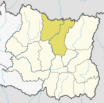
| Zone | Kosi Zone |
| District | Sankhuwasabha District |
| Population (1991) | |
| • Total | 3,044 |
| Time zone | UTC+5:45 (Nepal Time) |
| Postal code | 56903 |
| Area code | 029 |
Tamku is a village development committee in Sankhuwasabha District in the Kosi Zone of north-eastern Nepal. At the time of the 1991 Nepal census it had a population of 3044 people living in 588 individual households.[1]
List of villages
- Sibha
- Lakuwa
- Yachamkha
- Sintup
- Saptael
- Kanpek
- Sikidim
- Saija
- Pantima
- Khanigaun
- kolba
References
- ^ "Nepal Census 2001". Nepal's Village Development Committees. Digital Himalaya. Retrieved 19 November 2008.
External links
- UN map of the municipalities of Sankhuwasabha District
- v
- t
- e
Sankhuwasabha District
Headquarters: Khandbari Municipality
- Bhotkhola
- Chichila
- Makalu
- Savapokhari
- Silichong
 | This article about a location in the Sankhuwasabha District of Nepal is a stub. You can help Wikipedia by expanding it. |
- v
- t
- e


