Tanjung Redeb
You can help expand this article with text translated from the corresponding article in Indonesian. (April 2022) Click [show] for important translation instructions.
- View a machine-translated version of the Indonesian article.
- Machine translation, like DeepL or Google Translate, is a useful starting point for translations, but translators must revise errors as necessary and confirm that the translation is accurate, rather than simply copy-pasting machine-translated text into the English Wikipedia.
- Do not translate text that appears unreliable or low-quality. If possible, verify the text with references provided in the foreign-language article.
- You must provide copyright attribution in the edit summary accompanying your translation by providing an interlanguage link to the source of your translation. A model attribution edit summary is
Content in this edit is translated from the existing Indonesian Wikipedia article at [[:id:Tanjung Redeb, Berau]]; see its history for attribution. - You may also add the template
{{Translated|id|Tanjung Redeb, Berau}}to the talk page. - For more guidance, see Wikipedia:Translation.
Town and District in East Kalimantan, Indonesia
Tanjung Redeb | |
|---|---|
Town and District (kecamatan) | |
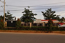 Tanjung Redeb sub-district office | |
| Country |  Indonesia Indonesia |
| Province | East Kalimantan |
| Regency | Berau |
| Villages/Sub-districts | 6 sub-districts |
| Government | |
| Area | |
| • Total | 24.42 km2 (9.43 sq mi) |
| Population (2020) | |
| • Total | 67,816 |
| • Density | 2,800/km2 (7,200/sq mi) |
2°9′13″N 117°29′49″E / 2.15361°N 117.49694°E / 2.15361; 117.49694
Tanjung Redeb is a town and district which is the administrative centre of Berau Regency, in East Kalimantan Province, Indonesia. It covers an area of 24.42 km2, and at the 2020 Census it had a population of 71,231.[1]
Climate
Tanjung Redeb has a tropical rainforest climate (Af) with moderate rainfall from July to September and heavy rainfall in the remaining months.
| Climate data for Tanjung Redeb | |||||||||||||
|---|---|---|---|---|---|---|---|---|---|---|---|---|---|
| Month | Jan | Feb | Mar | Apr | May | Jun | Jul | Aug | Sep | Oct | Nov | Dec | Year |
| Mean daily maximum °C (°F) | 29.9 (85.8) | 30.0 (86.0) | 30.2 (86.4) | 30.4 (86.7) | 30.7 (87.3) | 30.4 (86.7) | 30.4 (86.7) | 30.7 (87.3) | 30.7 (87.3) | 31.0 (87.8) | 30.7 (87.3) | 30.2 (86.4) | 30.4 (86.8) |
| Daily mean °C (°F) | 26.3 (79.3) | 26.4 (79.5) | 26.6 (79.9) | 26.8 (80.2) | 27.1 (80.8) | 26.8 (80.2) | 26.7 (80.1) | 26.9 (80.4) | 26.9 (80.4) | 27.1 (80.8) | 27.0 (80.6) | 26.5 (79.7) | 26.8 (80.2) |
| Mean daily minimum °C (°F) | 22.8 (73.0) | 22.9 (73.2) | 23.1 (73.6) | 23.3 (73.9) | 23.5 (74.3) | 23.2 (73.8) | 23.0 (73.4) | 23.1 (73.6) | 23.1 (73.6) | 23.2 (73.8) | 23.3 (73.9) | 23.1 (73.6) | 23.1 (73.6) |
| Average rainfall mm (inches) | 193 (7.6) | 173 (6.8) | 152 (6.0) | 149 (5.9) | 159 (6.3) | 153 (6.0) | 121 (4.8) | 116 (4.6) | 122 (4.8) | 147 (5.8) | 201 (7.9) | 195 (7.7) | 1,881 (74.2) |
| Source: Climate-Data.org[2] | |||||||||||||
References
- v
- t
- e
Regencies and cities of East Kalimantan
Capital: Samarinda
- Berau
- Kutai Kartanegara
- West Kutai
- East Kutai
- Paser
- Penajam North Paser
- Mahakam Ulu

villages
- Bengalon
- Engkuni
- Penajam
- Sangkulirang
- Sendawar
- Sepaku
- Tanjung Redeb
- Tenggarong
 | This East Kalimantan location article is a stub. You can help Wikipedia by expanding it. |
- v
- t
- e


