Uhl, Kansas
Ghost town in Kansas, United States
39°49′45″N 98°52′06″W / 39.82917°N 98.86833°W / 39.82917; -98.86833785
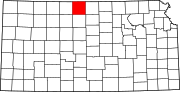
Uhl is a ghost town in Smith County, Kansas, United States.[1]
History
Uhl was issued a post office in 1886. The post office was discontinued in 1891.[2]
References
- ^ a b "Uhl, Kansas", Geographic Names Information System, United States Geological Survey, United States Department of the Interior
- ^ "Kansas Post Offices, 1828-1961: Smith County". Kansas Historical Society. Retrieved 12 April 2020.
- v
- t
- e
Municipalities and communities of Smith County, Kansas, United States
County seat: Smith Center
communities
- Banner
- Beaver
- Blaine
- Cedar
- Center
- Cora
- Crystal Plains
- Dor
- Garfield
- German
- Harlan
- Harvey
- Houston
- Lane
- Lincoln
- Logan
- Martin
- Oak
- Pawnee
- Pleasant
- Swan
- Valley
- Washington
- Webster
- White Rock
- Kansas portal
- United States portal
 | This article about a location in Smith County, Kansas is a stub. You can help Wikipedia by expanding it. |
- v
- t
- e


