Vintarovci
Place in Styria, Slovenia
46°29′32.3″N 15°51′44.59″E / 46.492306°N 15.8623861°E / 46.492306; 15.8623861 Slovenia
[1]
(2020)[2]
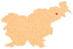
Vintarovci (pronounced [ˈʋiːntaɾɔu̯tsi]) is a settlement in the Municipality of Destrnik in northeastern Slovenia. It lies in the hills just west of Destrnik. The area is part of the traditional region of Styria. The municipality is now included in the Drava Statistical Region.[3]
There is a memorial to locals killed as soldiers in the First World War in the eastern part of the village in front of the Destrnik parish church. It has a 3 m obelisk and was erected in 1930.[4]
References
- ^ "Nadmorska višina naselij, kjer so sedeži občin" [Height above sea level of seats of municipalities] (in Slovenian and English). Statistical Office of the Republic of Slovenia. 2002. Archived from the original on 2013-05-24. Retrieved 2013-07-14.
- ^ "Vintarovci, Destrnik". Place Names. Statistical Office of the Republic of Slovenia. Retrieved 6 September 2012.
- ^ Destrnik municipal site
- ^ Slovenian Ministry of Culture register of national heritage reference number ešd 17591
External links
- Vintarovci on Geopedia
- v
- t
- e
Municipality of Destrnik
Administrative seat: Destrnik
- Desenci
- Dolič
- Drstelja
- Gomila
- Gomilci
- Janežovci
- Janežovski Vrh
- Jiršovci
- Levanjci
- Ločki Vrh
- Placar
- Strmec pri Destrniku
- Svetinci
- Vintarovci
- Zasadi
- Zgornji Velovlek