Yangpyeong-dong
Place in South Korea
Yangpyeong-dong | |
|---|---|
| Korean transcription(s) | |
| • Hangul | 양평동 |
| • Hanja | 楊坪洞 |
| • Revised Romanization | Yangpyeong-dong |
| • McCune–Reischauer | Yangp'yong-tong |
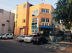 Yangpyeong 1-dong Community Service Center (Yeongdeungpo-gu) | |
| Country | South Korea |
| Area | |
| • Total | 3.88 km2 (1.50 sq mi) |
| Population (2001)[1] | |
| • Total | 36,104 |
| • Density | 9,300/km2 (24,000/sq mi) |
Yangpyeong-dong is a dong, neighborhood of Yeongdeungpo-gu in Seoul, South Korea.[1][2]
Overview
The Yangpyeong area, historically was Yangpyeong-ri, Sangbuk-myeon, Geumcheon-hyeon, Gyeonggi-do during the Joseon Dynasty, underwent several administrative changes over the years. In 1914, it was a part of Buk-myeon, Siheung-gun Yangpyeong-ri, and by 1920, it fell under the jurisdiction of Yeongdeungpo-myeon, Siheung-gun. In 1931, it was officially renamed Yangpyeong-ri, Yeongdeungpo-eup, Siheung-gun, and in 1936, it was integrated into Gyeongseong-bu and designated as Yanghwajang (楊花町). Following the liberation in 1946, it was reorganized as Yangpyeong-dong, Yeongdeungpo-gu. Concurrently, Yanghwa-dong was also renamed Yanghwa-dong, Yeongdeungpo-gu when the term "jeong (町)" was replaced with "dong" in October 1946.
Outline
Yangpyeong-dong is bordered by Yangcheon-gu to the west, Dangsan-dong to the east, and Munnae-dong to the south.[3] Yangpyeong-dong was Yangpyeong-ri Sangbuk-myeon, Geumcheon-hyun, Gyeonggi-do during the Joseon era.
Education
- Dangsan Elementary school
- Seonyoo Elementary school
- Seonyoo Middle school
- Han-gang Media High school
- Seonyoo High school
- Gwanak High school
See also
References
External links
- Yeongdeungpo-gu official website
- Yeongdeungpo-gu map at The Yeongdeungpo-gu official website
- (in Korean) Yangpyeong 1-dong resident office website
- v
- t
- e
Administrative Divisions (Dong) of Yeongdeungpo District
- Dangsan-dong
- Daerim-dong
- Dorim-dong
- Mullae-dong
- Singil-dong
- Yangpyeong-dong
- Yanghwa-dong
- Yeongdeungpo-dong
- Yeoui-dong
| ||||||
|---|---|---|---|---|---|---|
| Districts |
| |||||
| Business districts |
| |||||
This Seoul location article is a stub. You can help Wikipedia by expanding it. |
- v
- t
- e


