Abu Zurayq
permukiman depopulated Palestinian village (en) desa former settlement (en) | ||||
|---|---|---|---|---|
 | ||||
| Tempat | ||||
| Subdistrict of Mandatory Palestine (en) | Haifa Subdistrict (en) | |||
| Negara | Mandat Palestina | |||
| Geografi | ||||
| Luas wilayah | 6.493 km² | |||
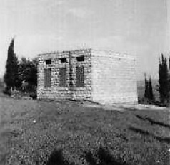
Abu Zurayq adalah sebuah situs arkeologi yang terletak di tepi barat Lembah Jezreel dan wilayah pertemuannya dengan Dataran Tinggi Menashe. Tempat tersebut berada di sebelah Jalan Tol 66, antara kibbutzim modern HaZore'a dan Mishmar HaEmek.
Referensi
Daftar pustaka
- Barron, J.B., ed. (1923). Palestine: Report and General Abstracts of the Census of 1922. Government of Palestine.
- Benveniśtî, M. (2000). Sacred landscape: the buried history of the Holy Land since 1948 (edisi ke-Illustrated). University of California Press. ISBN 0-520-21154-5. (pp. 74–77)
- Flapan, Simha[pranala nonaktif permanen] "The Palestinian Exodus of 1948" in 16, no. 4 (Sum. 87): 3–26.Simha Flapan records Eliezer Bauer of the HaShomer Hatiz kibbutz and a member of the Mapam Arab Department reporting during a discussion that the villagers of Abu Zrik and Abu Shusha were arrested or driven out and the villages were then destroyed.
- Gonen, Rivka (1992). Burial patterns and cultural diversity in late Bronze Age Canaan (edisi ke-Illustrated). EISENBRAUNS. ISBN 978-0-931464-68-3.
- Government of Palestine, Department of Statistics (1945). Village Statistics, April, 1945.
- Hadawi, S. (1970). Village Statistics of 1945: A Classification of Land and Area ownership in Palestine. Palestine Liberation Organization Research Center. Diarsipkan dari versi asli tanggal 2018-12-08. Diakses tanggal 2009-08-18. Parameter
|url-status=yang tidak diketahui akan diabaikan (bantuan) - Khalidi, W. (1992). All That Remains: The Palestinian Villages Occupied and Depopulated by Israel in 1948. Washington D.C.: Institute for Palestine Studies. ISBN 0-88728-224-5.
- Morris, B. (2004). The Birth of the Palestinian Refugee Problem Revisited. Cambridge University Press. ISBN 978-0-521-00967-6.
- Palmer, E.H. (1881). The Survey of Western Palestine: Arabic and English Name Lists Collected During the Survey by Lieutenants Conder and Kitchener, R. E. Transliterated and Explained by E.H. Palmer. Committee of the Palestine Exploration Fund.
- Yusuf, Muhsin; Anabisa, Ghaleb (2008). "Territorial Awareness In the 1834 Palestinian Revolt". Dalam Roger Heacock. Les Turkmènes en Palestine: histoire et devenir (dalam bahasa French). Beirut: Presses de l'Ifpo. ISBN 978-2-35159-265-6. Pemeliharaan CS1: Bahasa yang tidak diketahui (link)
- Ayala Sussmann, Avner Raban (2013). Mishmar HaEmek - 32 (dalam bahasa Hebrew). Israel Antiquities Authority. ISBN 978-965-406-029-5. Pemeliharaan CS1: Bahasa yang tidak diketahui (link)
- Tel Zariq
- Tel Zariq (south)
- ‘En Zariq
- Tel Zariq (M)
- Yosef Garfinkel and Zinovi Matskevich (2002). "Abu Zureiq, a Wadi Rabah Site in the Jezreel Valley: Final Report of the 1962 Excavations". Israel Exploration Journal. Israel Exploration Society. 52 (2): 129–166. JSTOR 27927004.
- Kenneth Kitchen (1989). "An Early West-Semitic Epigraph on a Scarab from Tell Abu Zureiq?". Israel Exploration Journal. Israel Exploration Society. 39 (3/4): 278–280. JSTOR 27926160.
- Yotam Tepper (2013). "Megiddo – Yoqne'am–Megiddo Junctions, Survey (Road 66): Final Report". Hadashot Arkheologiyot: Excavations and Surveys in Israel. Israel Antiquities Authority. 125.
Pranala luar
- Welcome to Abu-Zurayq, Palestine Remembered
- Abu Zurayq, from Zochrot
- Survey of Western Palestine, Map 8: IAA, Wikimedia Commons


