Blaby
Niet-metropolitaans district in Engeland  | |||
|---|---|---|---|
  | |||
| Situering | |||
| Land | Engeland | ||
| County | Leicestershire | ||
| Regio | East Midlands | ||
| Coördinaten | 52°34'23"NB, 1°12'18"WL | ||
| Algemeen | |||
| Oppervlakte | 130,4686[1] km² | ||
| Inwoners (2018[2]) | 100.421 (770 inw./km²) | ||
| ONS-code | E07000129 | ||
| Website | Officiële website | ||
| Detailkaart | |||
 | |||
| |||

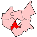
Blaby is een Engels district in het shire-graafschap (non-metropolitan county OF county) Leicestershire en telt 100.000 inwoners. De oppervlakte bedraagt 130 km².
Van de bevolking is 15,1% ouder dan 65 jaar. De werkloosheid bedraagt 2,1% van de beroepsbevolking (cijfers volkstelling 2001).
Civil parishes in district Blaby
Aston Flamville, Blaby, Braunstone, Cosby, Countesthorpe, Croft, Elmesthorpe, Enderby, Glen Parva, Glenfields, Huncote, Kilby, Kirby Muxloe, Leicester Forest East, Leicester Forest West, Lubbesthorpe, Narborough, Potters Marston, Sapcote, Sharnford, Stoney Stanton, Thurlaston, Whetstone, Wigston Parva.
Bronnen, noten en/of referenties
- ↑ Office for National Statistics → Download → SAM_for_Administrative_Areas_(2018).zip → SAM_LAD_DEC_2018_UK.xlsx. Gearchiveerd op 7 april 2023.
- ↑ https://www.ons.gov.uk/file?uri=/peoplepopulationandcommunity/populationandmigration/populationestimates/datasets/populationestimatesforukenglandandwalesscotlandandnorthernireland/mid20182019laboundaries/ukmidyearestimates20182019ladcodes.xls Schatting Office for National Statistics: knop MYE5 → kolom Estimated Population mid-2018]
- Volkstelling 2001, Office for National Statistics


